

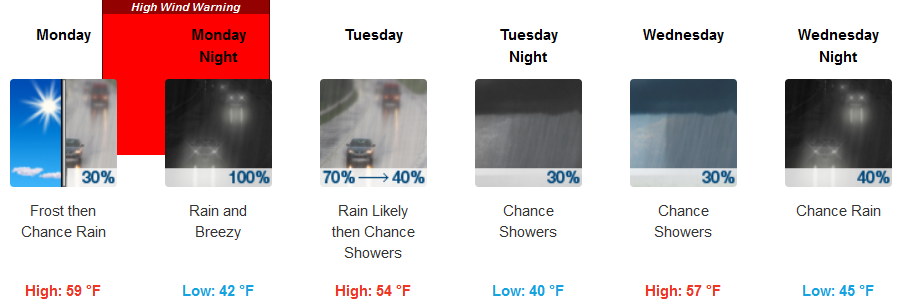
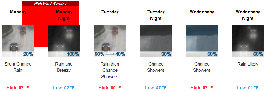
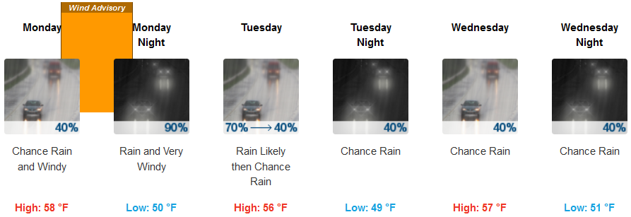
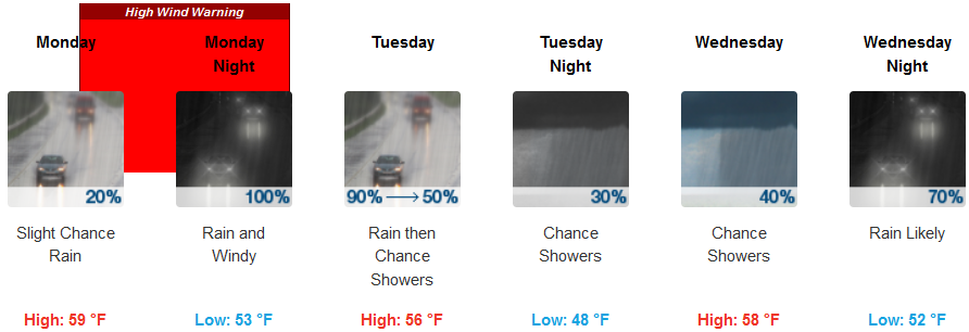
Multiple High Wind Warnings have been issued as gusty winds are expected Monday afternoon through Tuesday morning as a front moves through the area. This system is associated with cool temperatures, bringing temperatures across the region up to 10 degrees cooler in some areas.
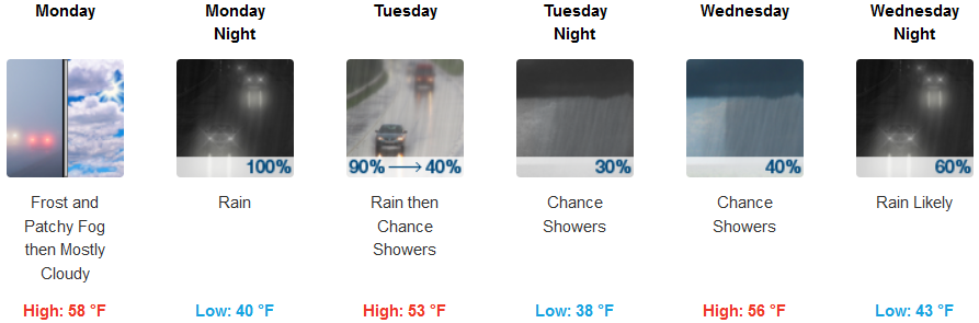
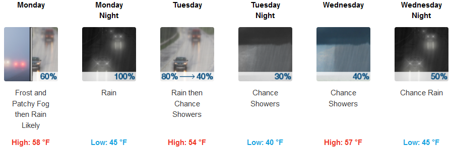
Inland, High Wind Warnings have been issued for Medford and surrounding areas beginning likely by Monday afternoon or early evening. Temperatures are expected to be cold in the higher elevations such as Cave Junction, ranging from just above freezing for early morning lows, and the mid 40’s for valley areas, to the mid 50’s by the afternoon.
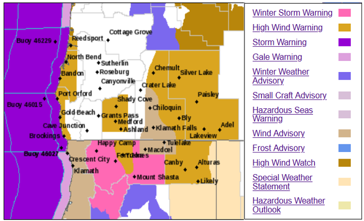
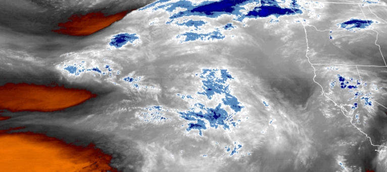
Along the coast, a High Wind Warning is now in effect from Bandon to the Oregon California stateline, continuing until 4:00am Tuesday morning. South winds of 25 to 35 mph winds with gusts to 70 are forecast to do widespread damage and cause dangerous driving conditions. Rain is forecast to begin across the coastal regions Monday, increasing as the afternoon progresses, and continuing throughout the week. Temperatures will be surprising mild with highs in the low 50’s and early morning lows in the mid 40’s.
Brookings:
Crescent City:
Gold Beach:
Cave Junction:
Grants Pass:
Medford: