

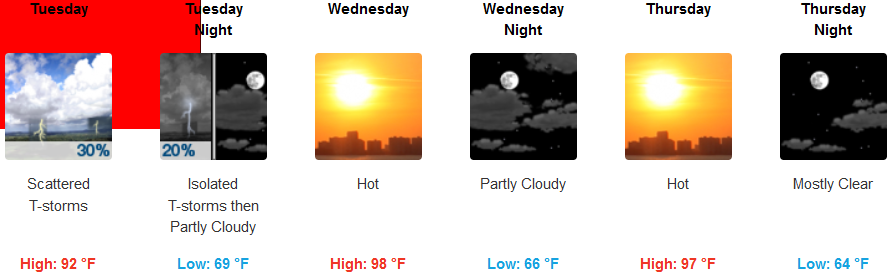
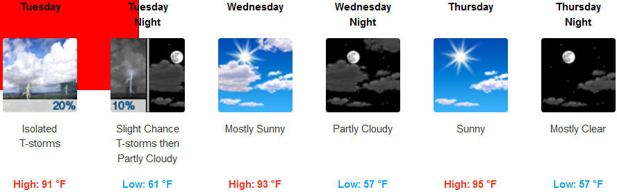
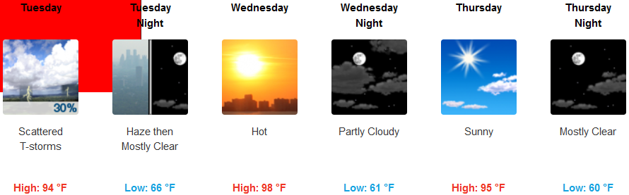
After record highs through last week, an upper level low from the west began to move into the region over the weekend, pushing the ridge of high pressure responsible for the stifling high temperatures to the east. The disturbance circulating over southeastern Nevada, producing the monsoonal moisture causing widespread storms and flooding in the southwest observed over the past few days, will continue to circulate a combination of gusty winds, low humidities and thunderstorms with cloud-to-ground lightning and limited rainfall across much of eastern Oregon through Wednesday.
Red Flag Warnings from the National Weather Service remain across much of southern Oregon and northern California into the middle of the work week. However, an upper level low that brought thunder storms to much of the coast Sunday evening is expected to bring much more pleasant temperatures to interior valleys compared to the recent heat wave.
Ongoing wildfires will continue to cause smoke to thicken across the region, and the Red Flag warnings combined with high temperatures and the potential for gusty winds has prompted fire danger levels to be increased to ‘Extreme’. Inland areas are expected to continue to experience isolated showers and thunderstorms through late Tuesday evening before clearing and becoming mostly sunny and hot, with late afternoon high temperatures reaching the upper 90’s.
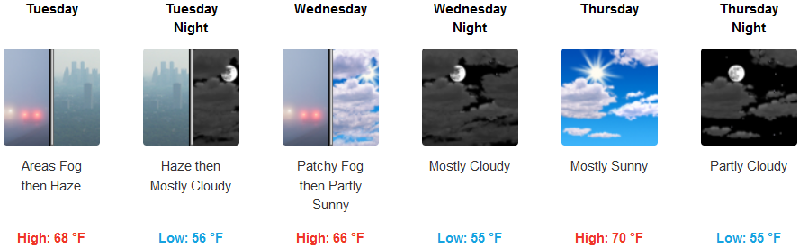
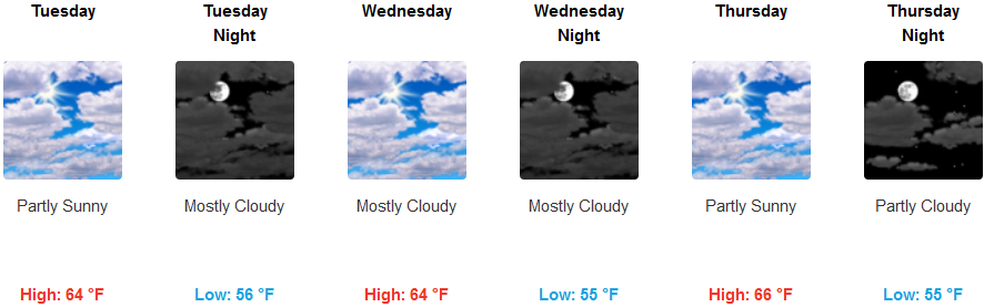
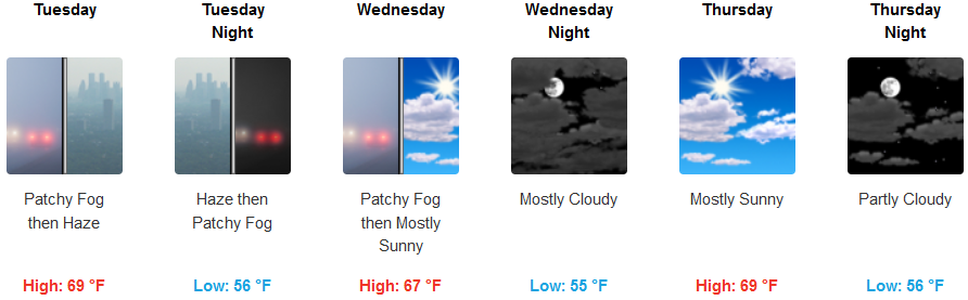
Along the coast, skies are expected to be hazy, with an early morning marine layer producing pockets of localized fog in some areas. Mostly cloudy skies will decrease as the work week proceeds, keeping high temperatures in the low 60’s early in the week, increasing to possibly the low 70’s in some coastal areas as clouds decrease later in the week.
Brookings:
Crescent City:
Gold Beach:
Cave Junction:
Grants Pass:
Medford: