

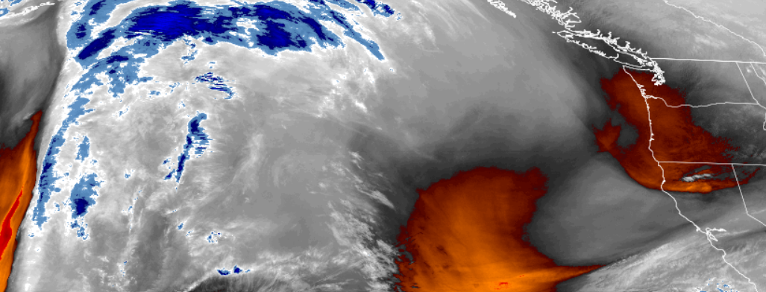
A low pressure system circulating to the south caught the bottom edge of a weak frontal boundary pressing down from the north bringing localized rain showers to much of southern Oregon Sunday night and into Monday morning, ushering in a cold front that will drop temperatures below normal for many areas.
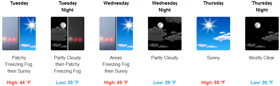
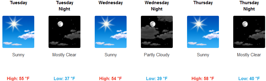
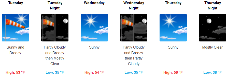
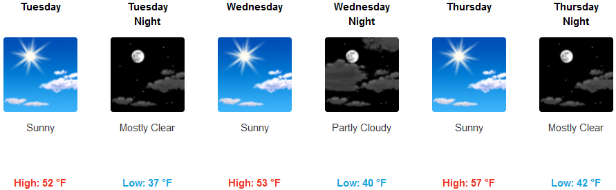
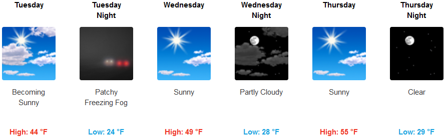
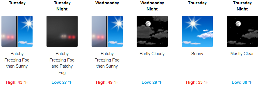
Much of the region will mostly see partly cloudy skies as the week progresses, with cold air getting into the mid 20’s in some locations. Freezing fog and icy road conditions will be likely in some areas, along with chances of gusty winds along southern coastal areas as the work week progresses.
Temperatures across southern Oregon and northern California will see early morning lows in the mid 20’s at higher elevations inland, however, reaching the low to mid 30’s along coastal areas. High temperatures could reach the mid to upper 50’s.
Brookings:
Crescent City:
Gold Beach:
Cave Junction:
Grants Pass:
Medford: