is on Campus")


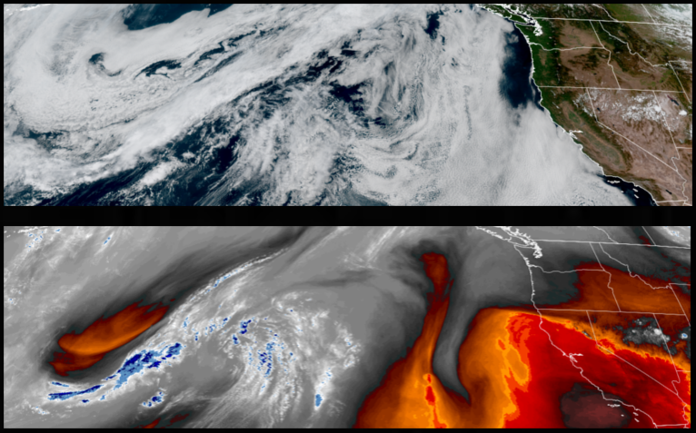
The warm temperatures across the region are expected to continue as a ridge of high pressure builds off the northwest coast, however, the warmest temperatures may have past Sunday and Monday to begin as a quick round of unstable air moves through bringing wind and the possibility of thunderstorms to start the work week.
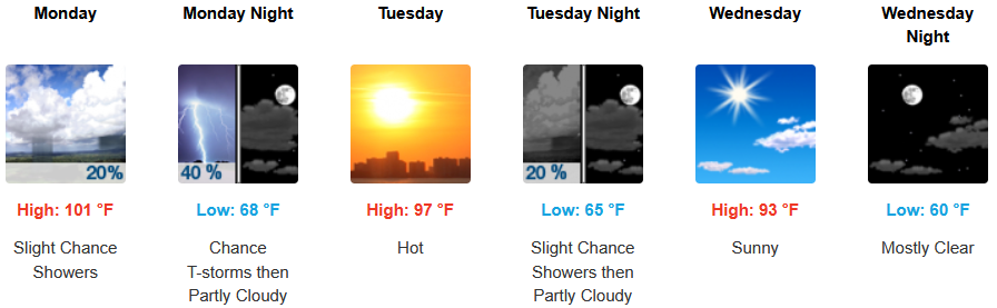
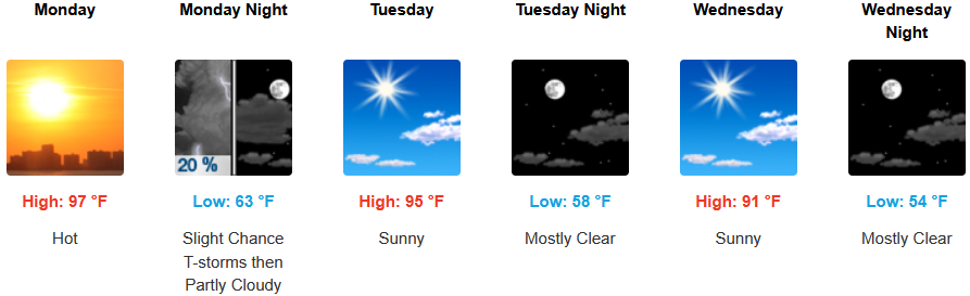
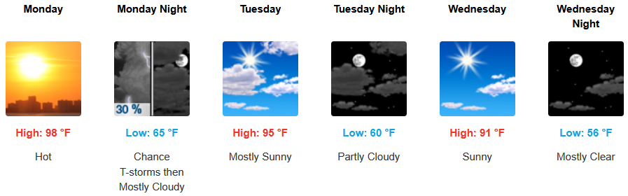
Inland areas will see warm temperatures and increasing clouds to start the week, with a chance of showers and thunderstorms late Monday. Temperatures are expected to cool into midweek, with afternoon highs expected to reach the mid to upper 90’s with morning lows forecast to be in the low 60’s.
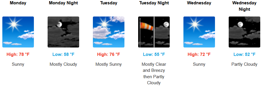
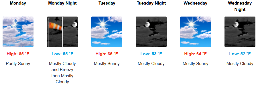
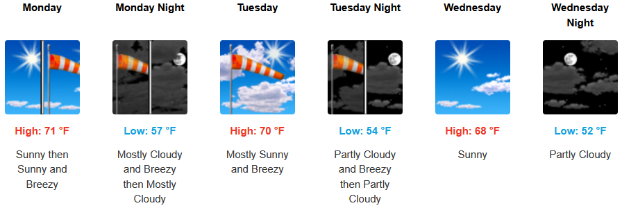
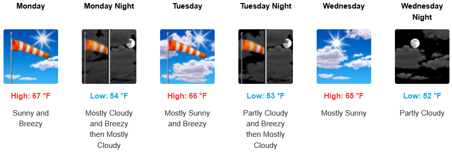
Along the coast, mostly clear to partly cloudy skies will continue with a northwest wind gusting to 30mph into midweek along the immediate coast. Afternoon highs are forecast to reach the to mid 70’s, with morning lows cooling to the upper 50’s.
Brookings:
Crescent City:
Gold Beach:
Port Orford:
Cave Junction:
Grants Pass:
Medford: