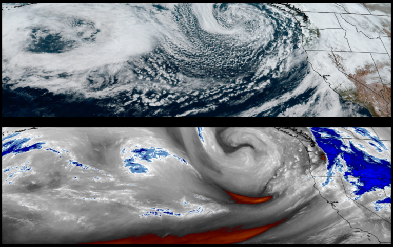
The low pressure circulating off the coast of Washington has pushed a series of wet systems through the region to start the week, and unfortunately, is expected to continue this pattern to finish the work week, however, skies are expected to clear Saturday and Sunday with some warmer weekend temperatures.
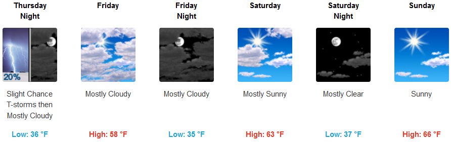
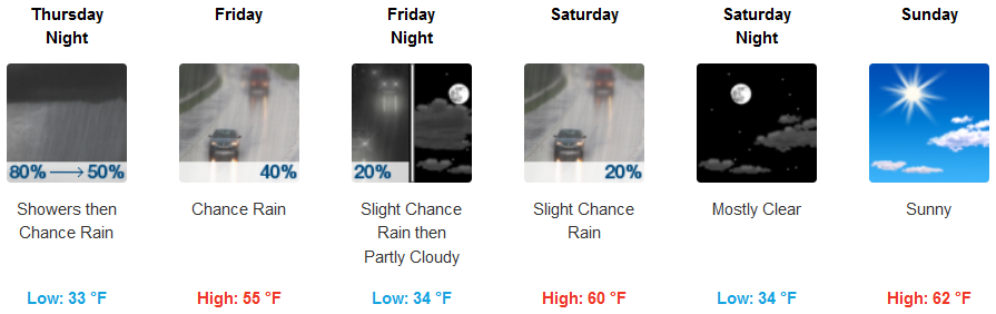
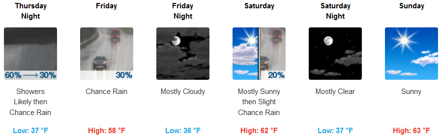
Inland areas are forecast to continue to see rain through Thursday before unstable air possibly produce isolated thunderstorms and areas of rain through Friday before the system moves to the east with partly cloudy skies to follow through the weekend. Inland temperatures are expected to stay in the low to mid 50’s for highs, before warming to the low to mid 60’s through the weekend.
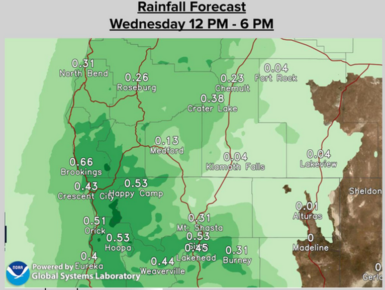
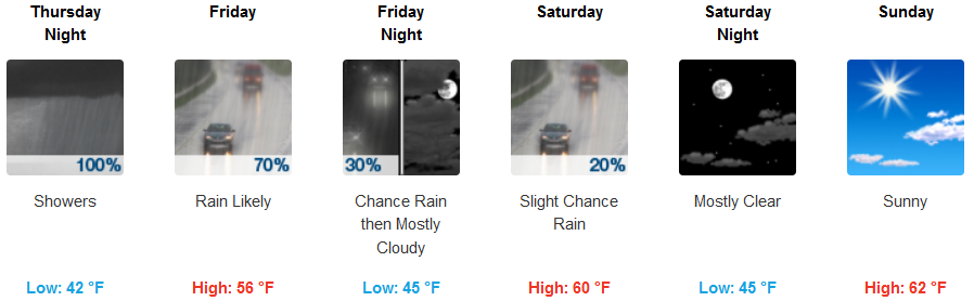
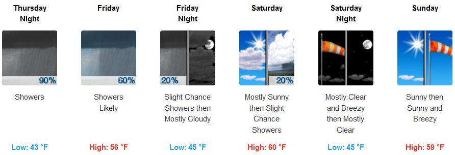
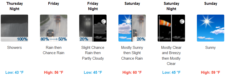
Along the coast, rain is expected to continue into Friday evening before sunny and breezy partly cloudy skies move into the area Saturday and Sunday. Temperatures will remain in the low 50’s for highs along the coast before warmer temperatures take over the weekend with highs reaching the low 60’s.
Brookings:
Crescent City:
Gold Beach:
Cave Junction:
Grants Pass:
Medford: