is on Campus")


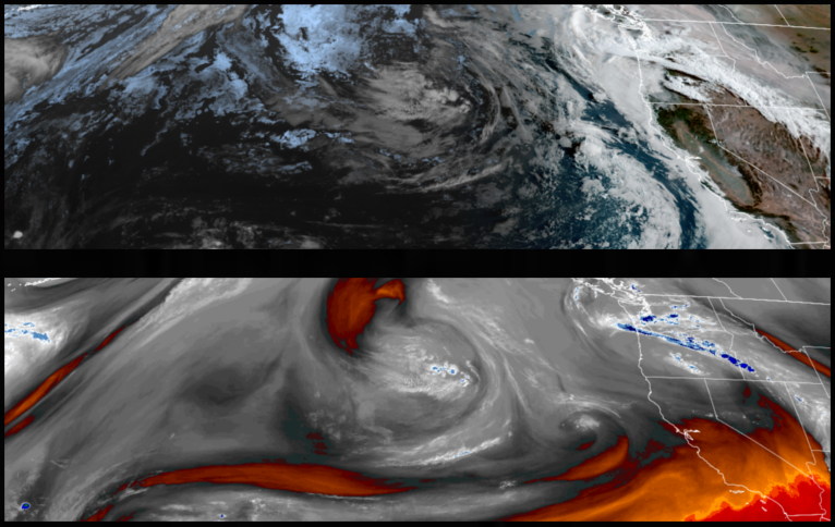
Big changes are on the way as a low pressure system moves into the region to start the work week, bringing below normal temperatures, widespread showers and the possibility of thunderstorms as early as Monday, continuing into midweek.
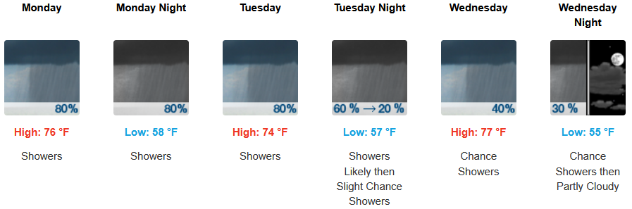
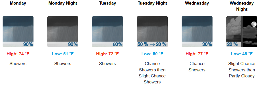
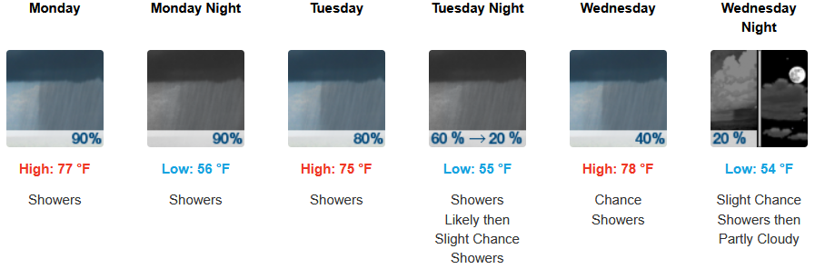
Inland areas can expect much cooler temperatures, showers, with thunderstorms possible beginning Monday and continuing through midweek. Afternoon highs are expected to fall to the mid to high 70’s across the region, with lows forecast to be in the low 50’s.
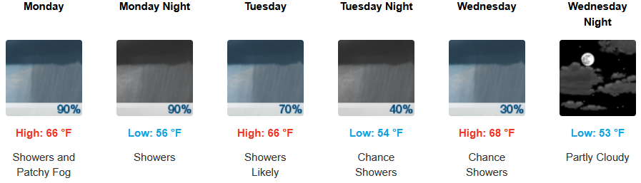
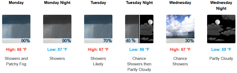
Along the coast, showers could begin to move onshore as early as late Sunday evening continuing into midweek with the marine layer continuing along the immediate coast. Temperatures are expected to stay in the low 60’s for highs in most areas with morning lows in the low 50’s.
Brookings:
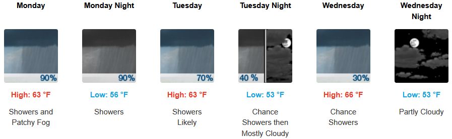
Crescent City:
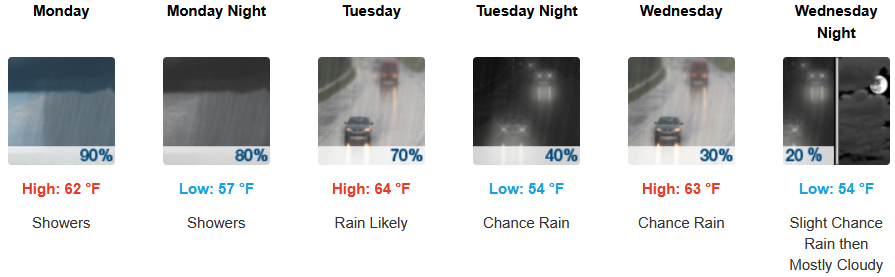
Gold Beach:
Port Orford:
Cave Junction:
Grants Pass:
Medford: