is on Campus")


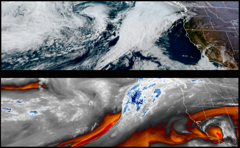
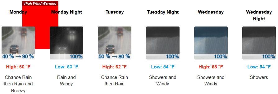
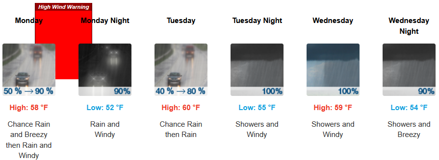
Big changes to start the workweek as another round of strong weather systems move into the area as early as late Monday, followed by more powerful systems as the workweek continues. Snow levels are expected to remain high, with strong southerly winds at the coast and moderate to heavy rain into midweek.
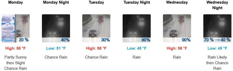
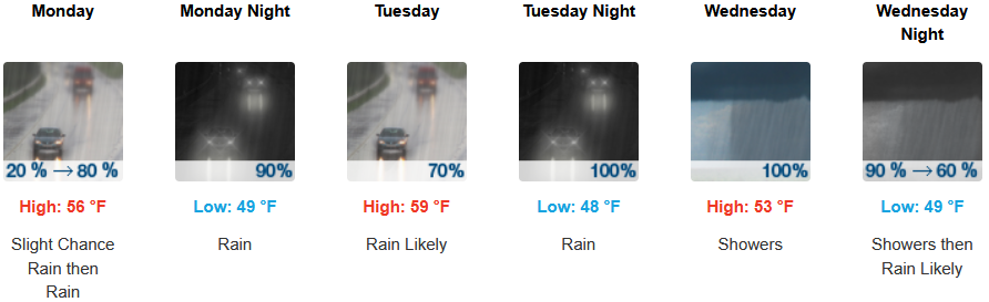
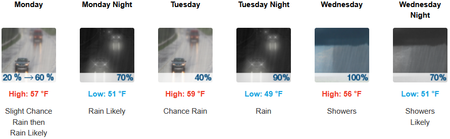
Inland areas are expected to see rain as early as Monday afternoon, with moderate to heavy rain and possible thunderstorms Wednesday, and a southeast 10 to 13mph wind. Afternoon highs are expected to be in the low 60’s, with lows forecast to be in the upper 40’s to low 50’s.
Along the coast, rain could start as early as early Monday morning, before heavier rain with possible thunderstorms and a south southeast wind from 22 to 26 mph, gusting as high as 41mph continuing into midweek. Temperatures are forecast to be in the low 60’s for highs, with morning lows in the upper 40’s.
Brookings:
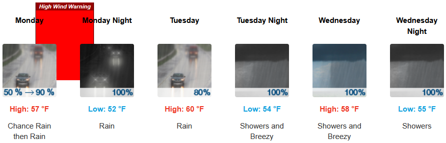
Crescent City:
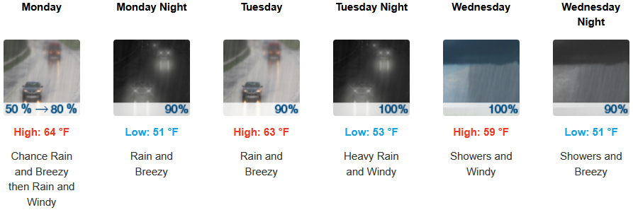
Gold Beach:
Port Orford:
Cave Junction:
Grants Pass:
Medford: