is on Campus")


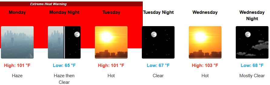
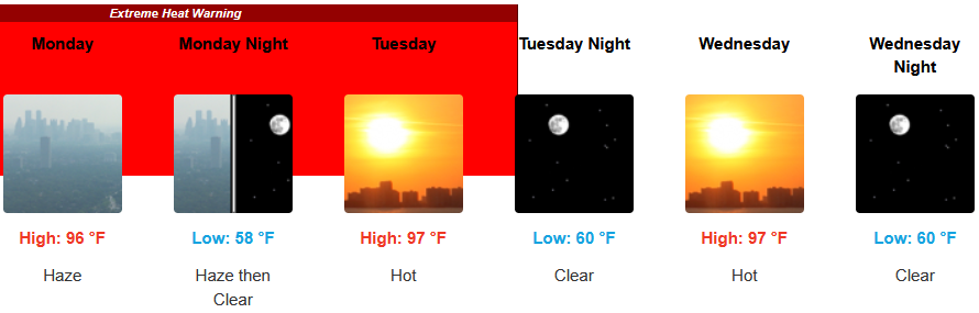
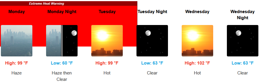
Extreme Heat Watches continue to be issued by the National Weather Service through Tuesday throughout central southern Oregon and northern California as off-shore ridging continues to produce conditions that are expected to keep daytime high temperatures into triple digits east of the coastline as the immediate coast remains cooler relatively speaking into mid-week.
Inland areas can expect to remain under Extreme Heat Watches throughout central southern Oregon and northern California through Tuesday evening triple digits afternoon highs and little relief in the evening. Afternoon highs expected to reach the low 100’s and relatively evening lows forecast to be in the mid to upper 60’s.
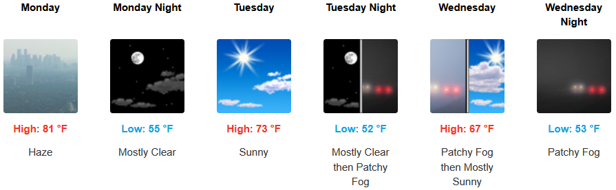
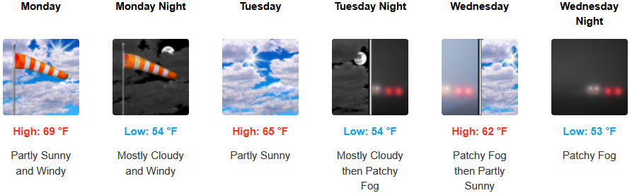
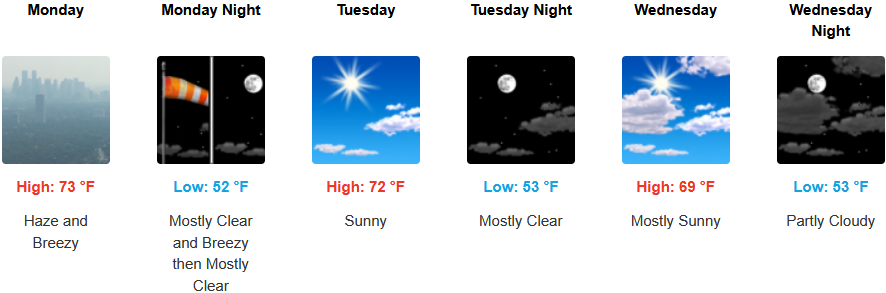
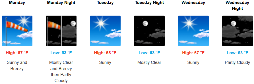
Along the coast a morning marine layer along the immediate coast and localized areas of morning fog are possible under afternoon sunny skies to start the work week. Temperatures are expected remain warm into the work week with temperatures reaching the high 70’s in some areas with morning lows in the mid 50’s.
Brookings:
Crescent City:
Gold Beach:
Port Orford:
Cave Junction:
Grants Pass:
Medford: