is on Campus")


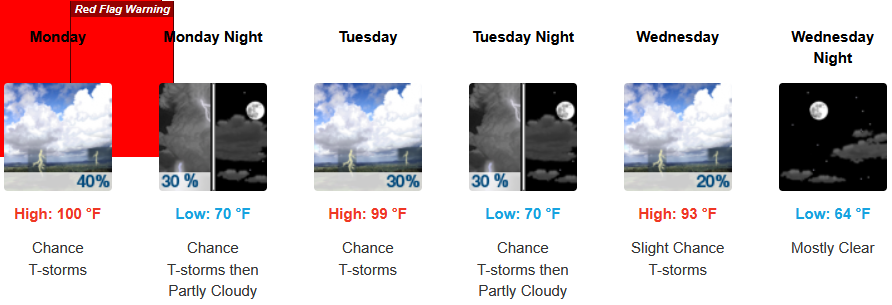
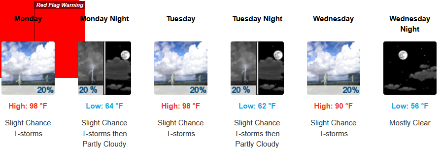
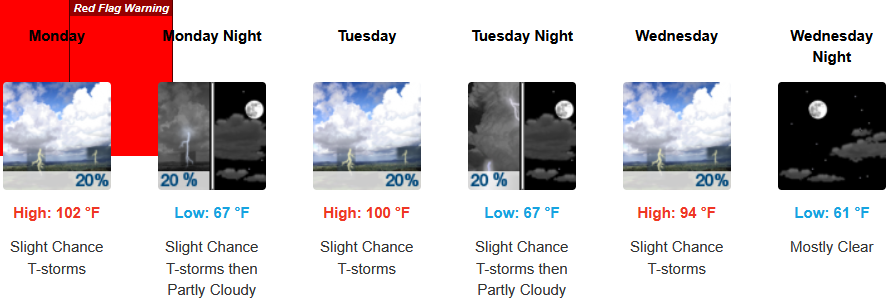
High pressure will continue to dominate the forecast to start the workweek with more high temperatures, however, an unstable monsoonal air mass has also moved into the area creating chances for thunderstorms daily primarily inland across northern California, but portions of Jackson and Josephine Counties could see storms producing gusty winds, hail and perhaps new fire starts.as well.
Inland areas will continue to see Extreme Heat Warnings and Heat Advisories from the National Weather Service across much of southern Oregon and northern California into Tuesday, with chances for thunderstorms gusty winds, and hail forecast to continue into midweek. Afternoon highs are expected to climb to mid to high triple digits with little relief overnight with lows forecast in the low 70’s.
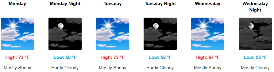
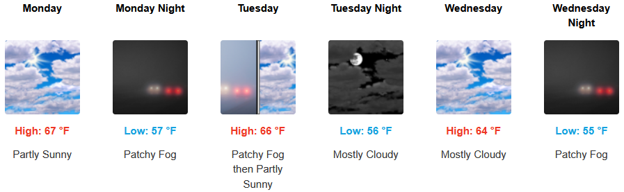
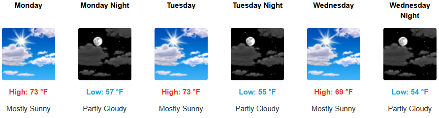
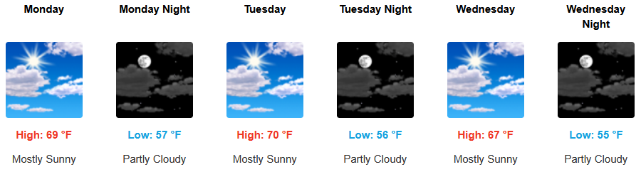
Along coastal areas temperatures are forecast to continue to be warm under mostly clear skies to start the workweek.. A continued morning marine layer along the immediate coast and localized areas of morning fog under mostly sunny afternoon skies through weekend. Temperatures are expected to reach the low to mid 70’s for highs in some areas with morning lows in the mid to upper 50’s.
Brookings:
Crescent City:
Gold Beach:
Port Orford:
Cave Junction:
Grants Pass:
Medford: