is on Campus")


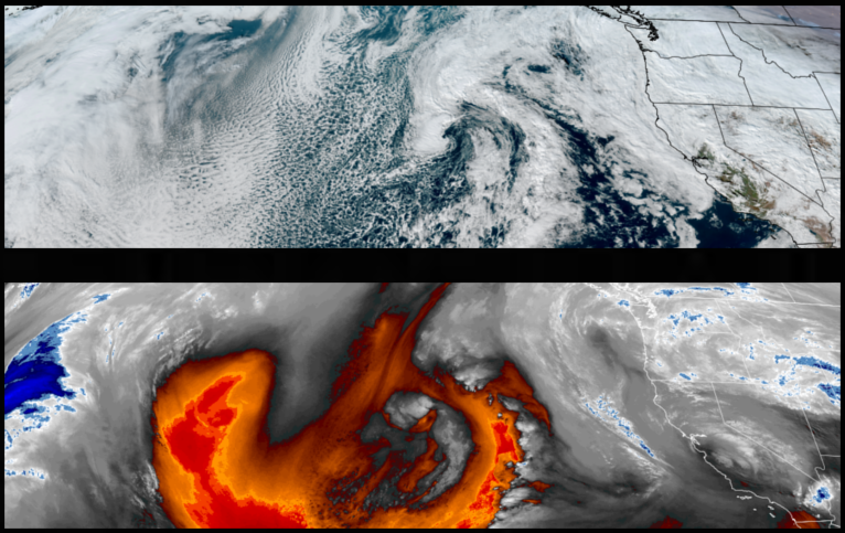
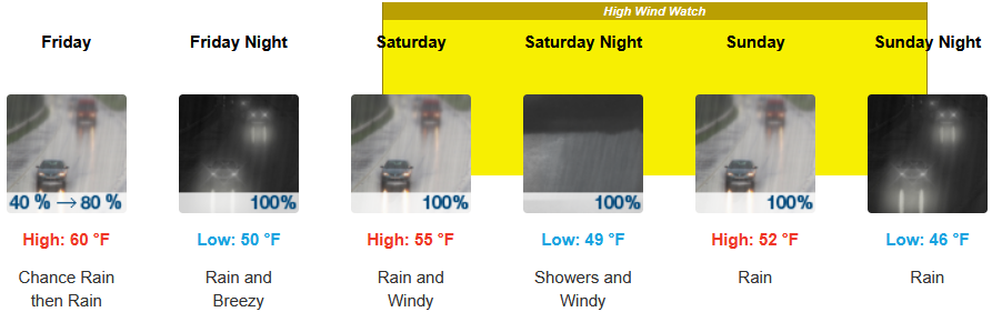
Wet weather returns to start the New Year as two fronts move across the region beginning Thursday with a short break Friday and rain returning with a High Wind Watch issued by the National Weather Service through Sunday. Be sure to check forecasts and road conditions before traveling as higher passages are expected to see heavy accumulations as snow levels drop to the 4000ft into Sunday.
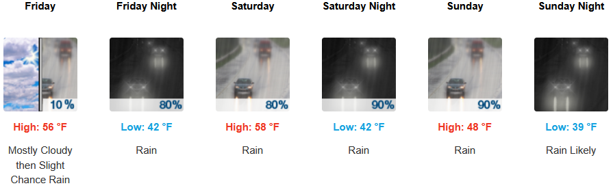
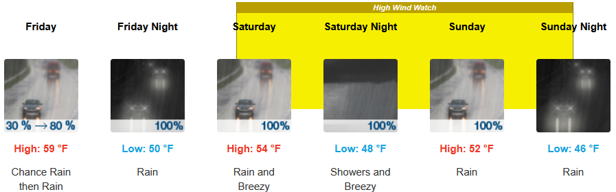
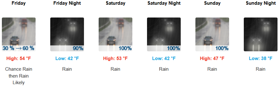
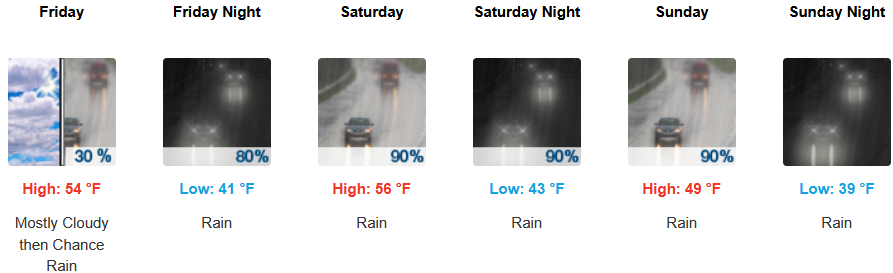
Inland areas can expect to see rain into Friday before a break in precipitation and the return of a rain late Friday evening through Sunday with snow levels as low as 4000ft. Afternoon highs start in the low 50’s before falling to the mid 40’s over the weekend, with lows forecast to be in the upper 30’s to low 40’s.
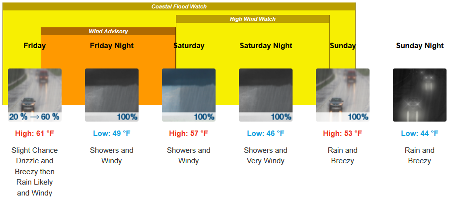
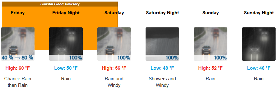
Along the coast, rain returned Thursday and is expected to continue into and through the weekend with a High Wind Watch issued by the National Weather Service forecasting 25 to 35 mph winds possibly gusting to 60 mph. Temperatures are forecast to be in the mid to upper 50’s for highs, with morning lows in the upper 40’s to low 50’s.
Brookings:
Crescent City:
Gold Beach:
Port Orford:
Cave Junction:
Grants Pass:
Medford: