is on Campus")


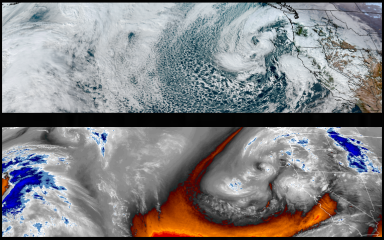
Rounds of rain, with snow possible above 3900′, are forecast to continue with bands of precipitation pushing onshore from the Pacific northwest to northern California as another low pressure system develops off the coast as the holiday weekend comes to an end. These systems could continue to have potential hazards of flooding, strong winds and snow in southern Oregon and northern California impacting holiday plans and travel.
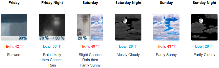
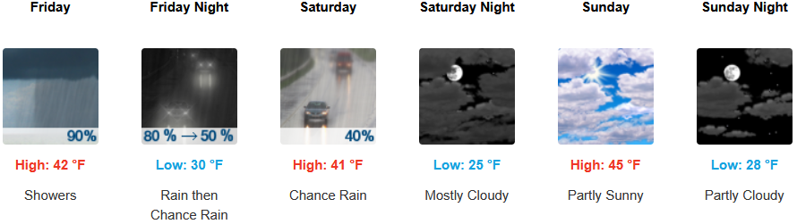
Rain, heavy at times, is forecast to continue inland as bands of moisture cycle over the region through the weekend with high snow levels above 3900′ as cooler air moves in. Skies are expected to clear as the holiday weekend comes to an end with afternoon highs in the 40’s, with lows forecast to be in the upper 20’s to low 30’s.
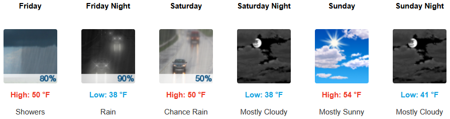
Along the coast, rain, heavy at times, is expected into the weekend, as another cooler weather system moves into the area during the weekend. Partly cloudy skies are forecast to end the holiday weekend with temperatures forecast to be in the mid 50’s for highs, with morning lows in the upper 30’s to low 40’s.
Brookings:
Crescent City:
Gold Beach:

Port Orford:

Cave Junction:
Grants Pass:

Medford: