is on Campus")


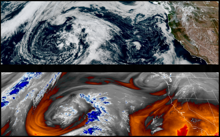
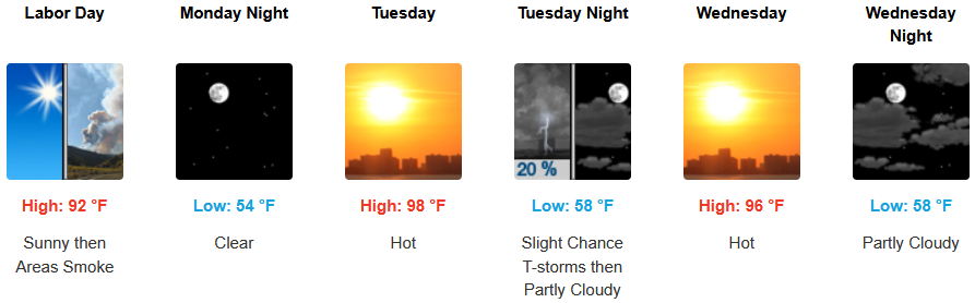
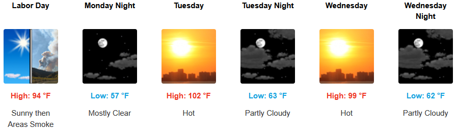
High pressure continues to keep warm temperatures across the region with the possibility of thunderstorms returning to the forecast inland going into midweek. The recent heat wave is expected to get warmer as the week progresses under mostly clear, sunny skies across the region.
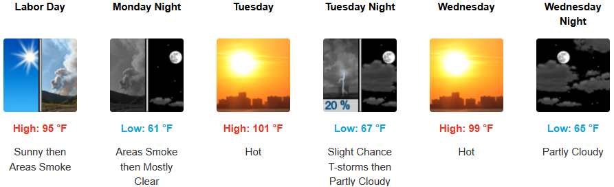
Mostly sunny skies are expected to continue with triple digit temperatures back in the forecast for the workweek. A chance of thunderstorms late Tuesday into Wednesday with afternoon highs expected to climb to the low 100’s in some areas into midweek, with lows forecast in the mid to upper 60’s.
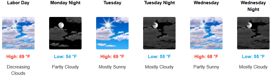
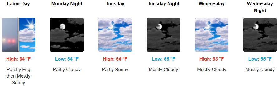
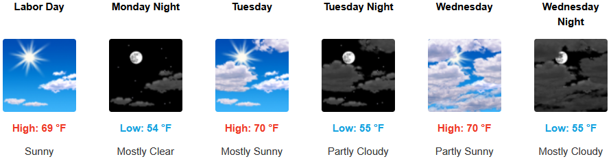
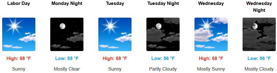
Along coastal, temperatures are forecast to continue to be warm under mostly clear skies into midweek. The usual morning marine layer along the immediate coast and localized areas of morning fog are expected to continue under mostly sunny afternoon skies. Temperatures are expected to reach the lupper 60’s to low 70’s for highs in some areas with morning lows in the low to mid 50’s.
Brookings:
Crescent City:
Gold Beach:
Port Orford:
Cave Junction:
Grants Pass:
Medford: