is on Campus")


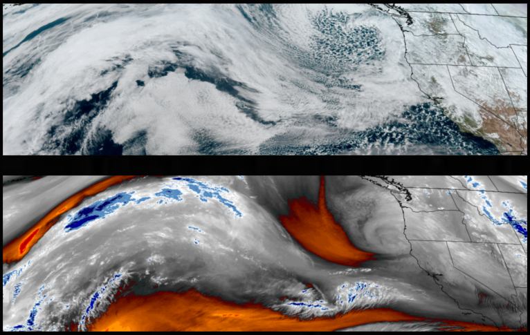
The strong low pressure system responsible for the cold temperatures and low snow elevations, has started to move to the east, however, it continues to push bands of precipitation onshore and the National Weather Service has issued another round of Winter Storm and Freeze Warnings throughout southern Oregon and northern California going into the weekend.
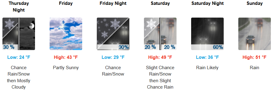
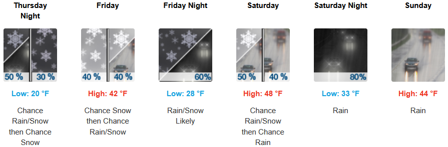
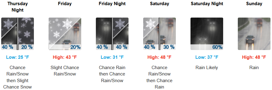
The Winter Storm Warnings issued by the National Weather Service for inland areas now continue into the weekend with rain, snow and cold temperatures continuing as another round of widespread snowfall is expected into Thursday morning, including the valley floors west of the Cascades. Afternoon highs are expected to end the work week in the low to mid to low 40’s, warming slightly into the weekend, with lows forecast to be in the upper 20’s to mid 30’s over the weekend.
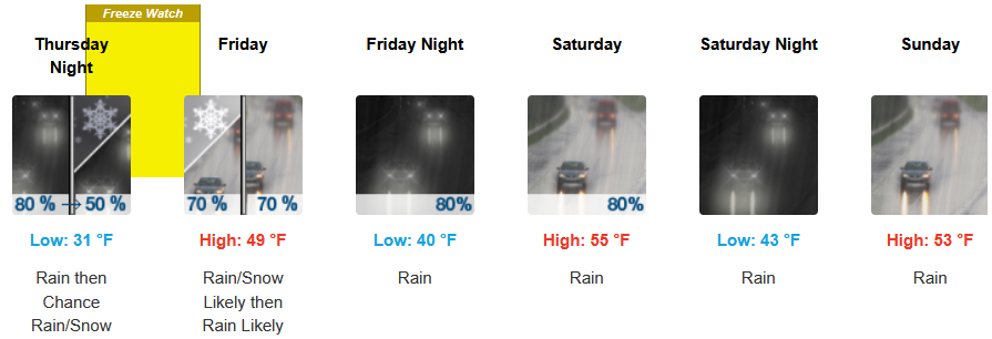
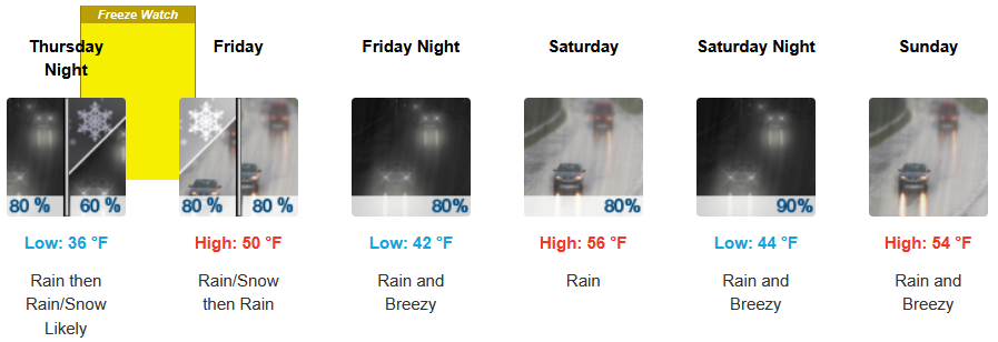
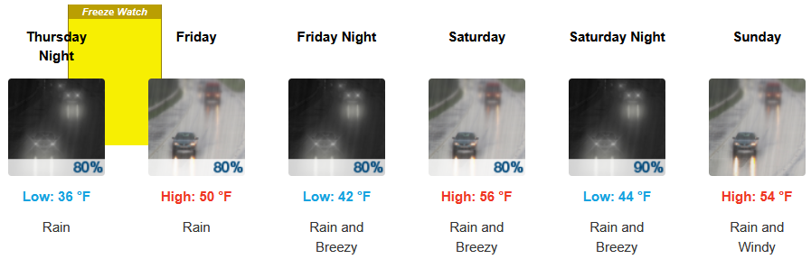
Along the coast, the National Weather Service has issued a Freeze Warning along the immediate coast Thursday into Friday morning with continued widespread rain expected to continue through the weekend and chances of snow Thursday into Friday morning. Temperatures are forecast to end the week in the upper 40’s before slightly warming to the mid 50’s for high’s as the week progresses, with morning lows starting in the low 30’s before rising to the low 50’s into weekend.

Brookings:
Crescent City:
Gold Beach:
Port Orford:
Cave Junction:
Grants Pass:
Medford: