

The weather system responsible for the previous bout of precipitation has now moved to the east ushering in another fast moving cold weather system expected to pass through the region bringing the possibility of locally heavy rain, mountain snow at high elevations as early as Friday afternoon. Snow levels are expected to remain relatively high at or above 4500ft., however, cold air pushing on shore is expected to lower snow levels to as low as 2000ft. in some locations. Slippery, snow covered roads are expected and travel may become difficult. Travelers should monitor conditions and plan for winter driving conditions.
Inland areas are forecast to see patchy partly cloudy skies in the morning hours Friday, changing to mostly cloudy skies Friday afternoon with a chance for precipitation late Friday evening and into Saturday morning with another colder system working into the area Sunday evening. Evening and morning lows are expected to be in the mid 30’s, dropping to the low 30’s and snow levels possibly as low as 2000ft.
Along the coast, rain is likely late Friday with chances of participation increasing as you move north, clearing slightly early Sunday with partly cloudy mostly sunny skies before the next system arrives to start the work week. Temperatures are expected to be in the low to mid 40’s in the morning, and highs reaching the low to mid 50’s as the weekend progresses.
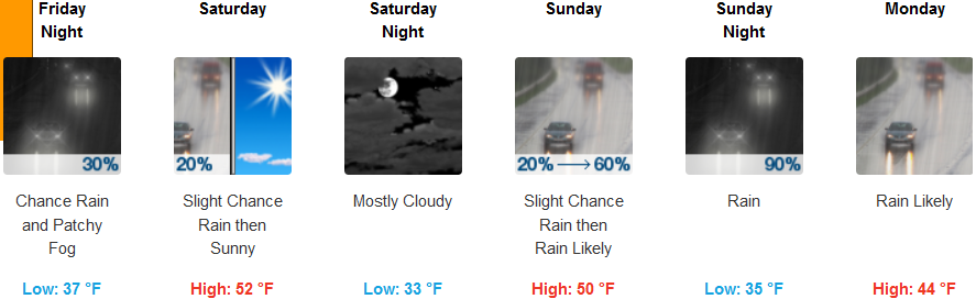
Brookings:
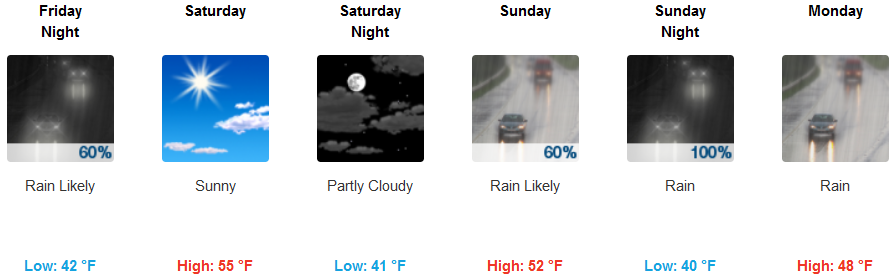
Crescent City:
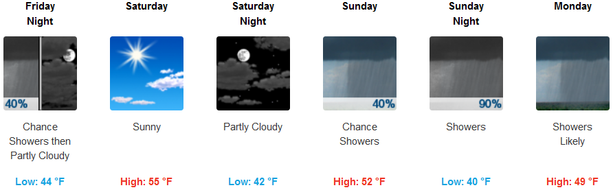
Gold Beach:
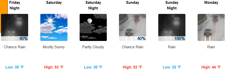
Cave Junction:
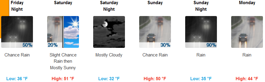
Grants Pass:
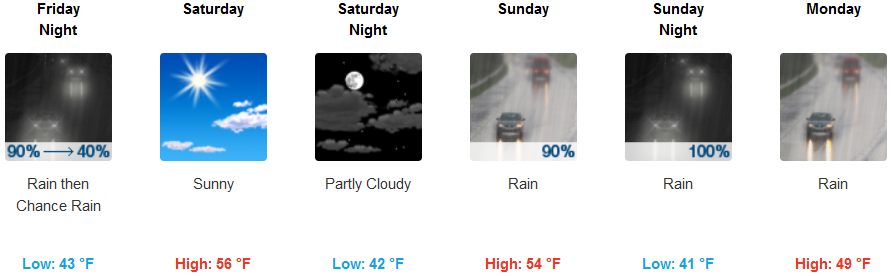
Medford: