

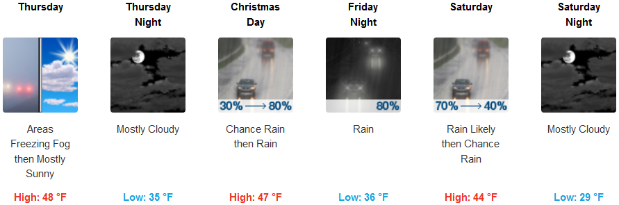
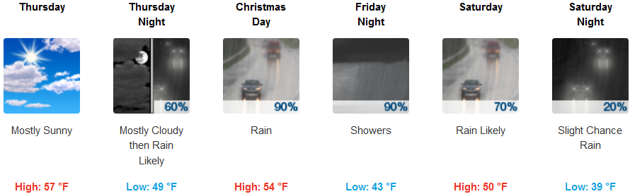
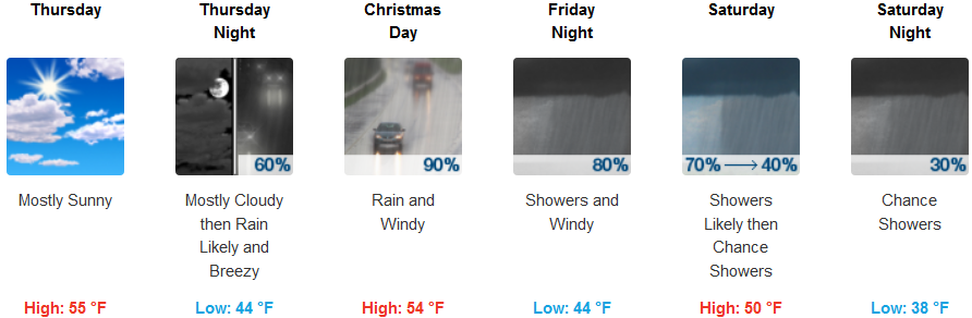
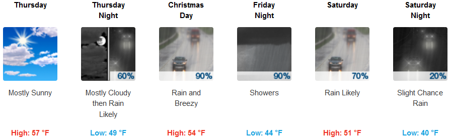
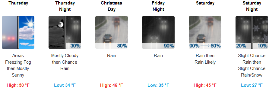
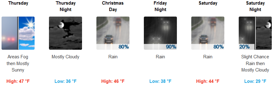
The Christmas weekend forecast calls for fog and low clouds in the morning with sunny and breezy conditions elsewhere. Over night on Christmas Eve a strong storm system is forecast to bring rain, wind and higher elevation snow to the area Friday and Saturday. Showers will continue on Saturday with lighter winds.
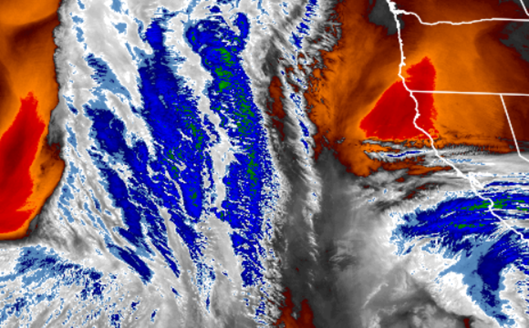
Strong winds are possible along the coast, in the Shasta Valley and east of the Cascades with breezy to gusty conditions in west side valleys. Snow levels are expected around 4000 to 5000 ft for most the area on Christmas with snow accumulations on higher mountain passes, including 8-12 inches on the passes in the Southern Oregon Cascades, 3-4 inches at Siskiyou Summit and 4-6 inches at Mount Shasta City. Showers will continued on Saturday. Another front is possible late Sunday.
Brookings:
Crescent City:
Gold Beach:
Cave Junction:
Grants Pass:
Medford: