


According to reports from the U.S. Forest Services Sunday morning Flat Fire update, after averaging 1,623 per day going into Saturday evenings infra-red imaging, Sunday morning revealed that the growth rate continued to grow close to the same rate overnight, burning 1,769 acres. Infra-red imaging Monday morning showed the fire grew another 1,834 acres, now covering more than 22,066 total acres, slowing considerably these past 2 days, averaging 1,742 acres per day since Friday’s last infrared imaging.
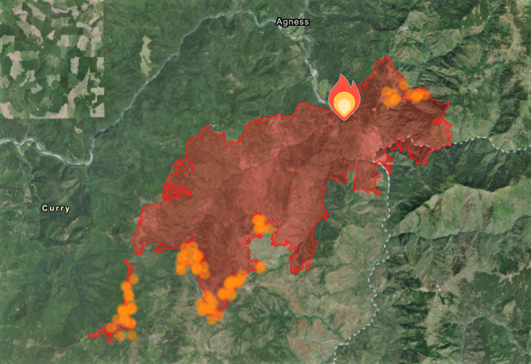
On Sunday morning the Rogue River-Siskiyou National Forest, in cooperation with the Pacific Northwest Incident Management Team 3, made a written request to the Pacific Northwest Regional Forester for permission to use heavy equipment in the Kalmiopsis Wilderness for Flat Fire suppression purposes. The request was approved and fire team operations moved forward with implementation during Sunday’s shift, utilizing existing old mining roads which were also utilized as a suppression line for the Klondike Fire. The dozer line starts at Game Lake and heads east, traversing the Kalmiopsis Wilderness at its northern boundary.
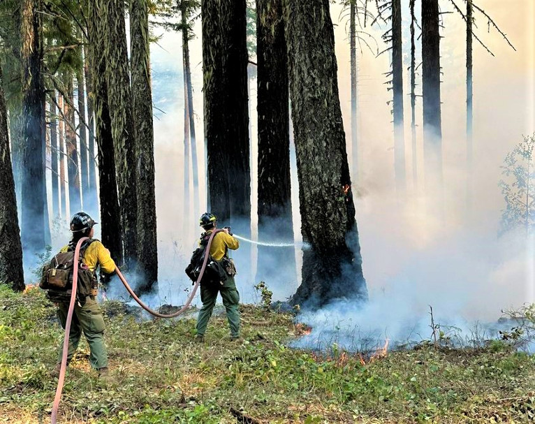
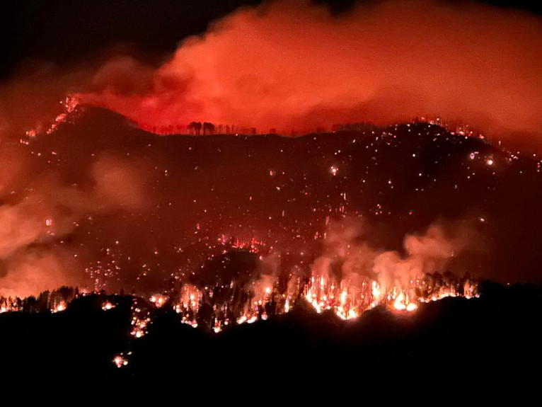
The southeast front of the fire has been active in the past few days, as crews patrolled the fire perimeter and worked to keep the fire within the control lines. Overnight crews continued burnout operations in the northeast section of the fire to further secure control lines as with other areas of the fire ahead of the fires front line, keeping fire behavior moderate and lower in intensity. Crews continue to clear snags and help create access to the fire itself.
With marine air moving into the area, the cooler temperatures and higher humidity have kept fire activity moderate with these conditions forecast to continue into the week, and fire crews took advantage of weather conditions over the past 36 hours securing, strengthening and creating new fire lines to slow and control the growth of the blaze and protect the communities of both Agness and Gold Beach.
Fire crews have been mopping up hot spots where burnout operations have been completed and have tied control lines from Illinois River to Wildhorse Lookout. There has been minimal spread to the north with the most active part of the fire being the west flank. In the southeast where the fire is burning in the Klondike Fire burn scar, fire activity is more moderate.
Currently the U.S. Forest Service has 1,497 total personnel deployed with 33 Engines, 40 crews, 8 bulldozers, 15 water tenders, 10 helicopters, and 8 masticators, used to grind or chew woody debris into one to two inch pieces leaving behind chipped woody debris.
Air resources continue to be utilized as conditions and visibility allow and additional resources continue to arrive and to strengthen and create new firelines while looking for opportunities to use existing roads and bodies of water as natural fire breaks.
The Curry County Sheriff’s Office issued an evacuation notices earlier in the week and continues sending evacuation notices utilizing Everbridge, which provides notices via phone. If you have not done so, please sign up by going to the Curry County website and click on the Everbridge notification link. https://www.co.curry.or.us/departments/emergency_management/index.php
The Rogue River Siskiyou National Forest has issued a closure order for the fire area including trails, roads, and a portion of the Illinois River and fire restrictions issued Monday also remain in place.