

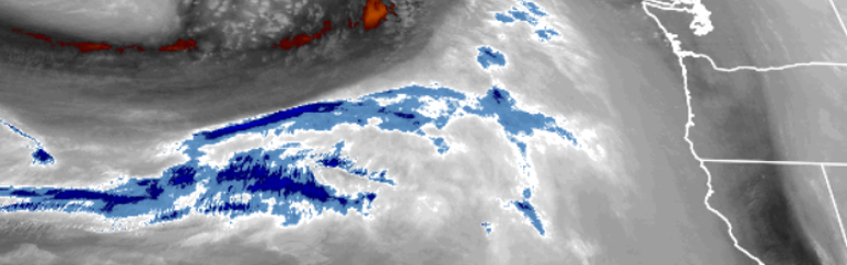
As seen in the satellite image above, cold air has been pushed into the southern Oregon and northern California area ahead of a long period of precipitation for the work week.
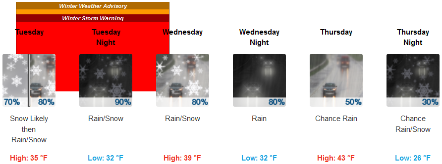
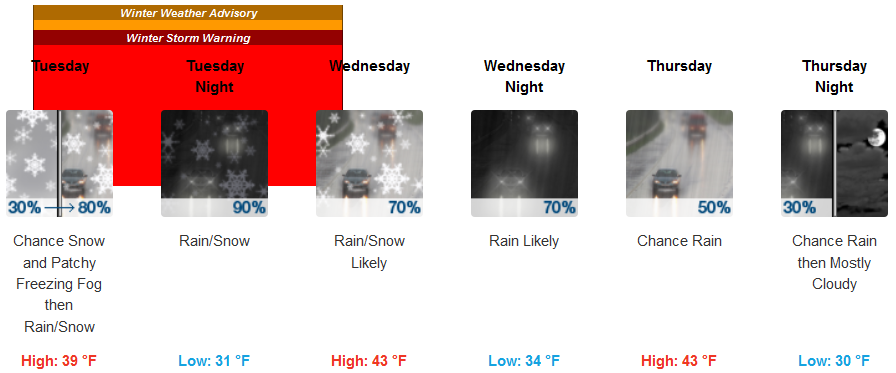
After a mass of unstable cold air produced periods of heavy rain and a dusting of snow in some low elevations Monday, Tuesday forecasts will usher in a major winter storm that will push on shore early Tuesday along coastal areas.
Very heavy accumulations of snow are forecast for portions of western Siskiyou County and in higher elevations of Josephine County while in the Mt. Shasta area this storm could produce very heavy snow in the 1 inch per hour rates for at least 12 hours with periods of 2 inch per hour rates.
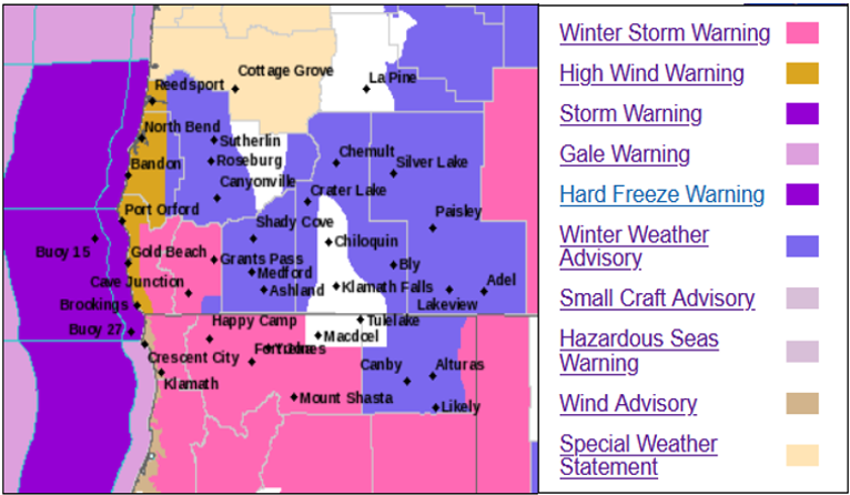
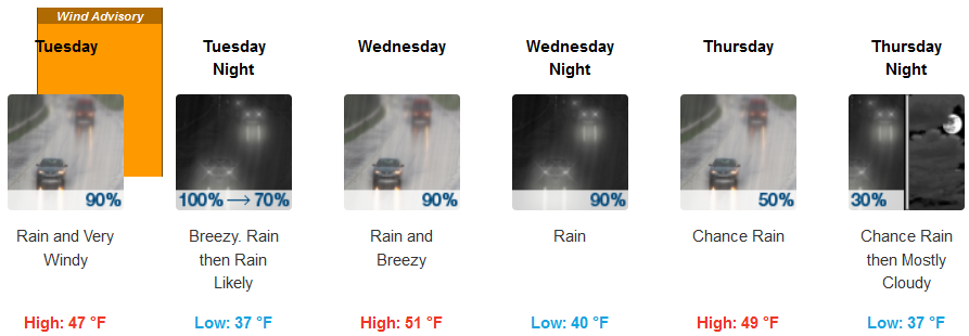
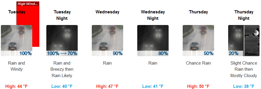
A high wind warning has been issued by the national weather service forecasting south winds from 35 to 45 mph with gusts around 60 mph expected along coastal headlands from Bandon southward through Brookings and Crescent City and as far south as Humboldt.
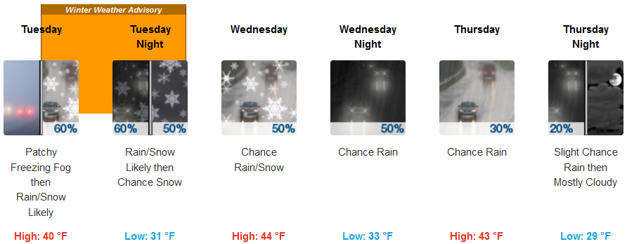
Brookings:
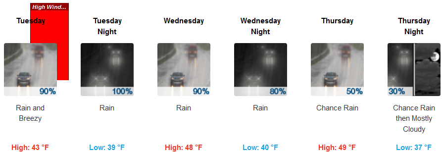
Crescent City:
Gold Beach:
Cave Junction:
Grants Pass:
Medford: