

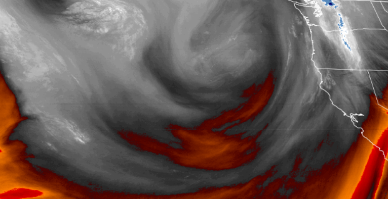
A cool low pressure system has moved into the Northwestern Pacific and has slowed significantly over the region as it pushes onto land. The system circulated moisture up from the south developing into an ‘atmospheric river’ that fed precipitation all along the coast, relentlessly dropping rainfall through out the past weekend, with totals in multiple inches in most locations.
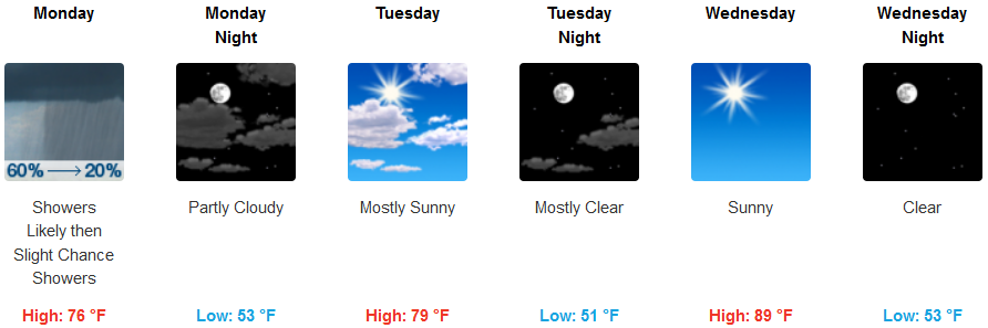
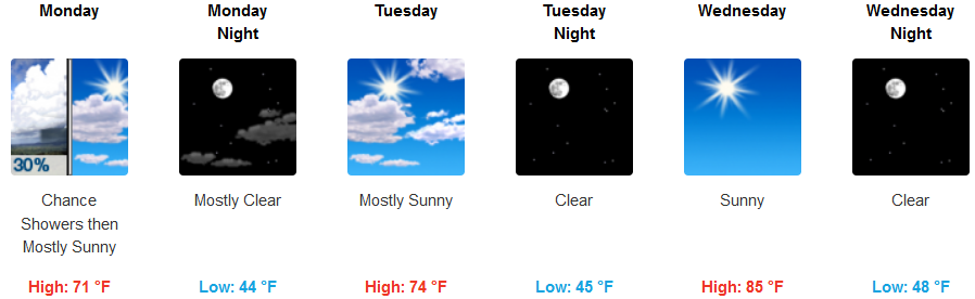
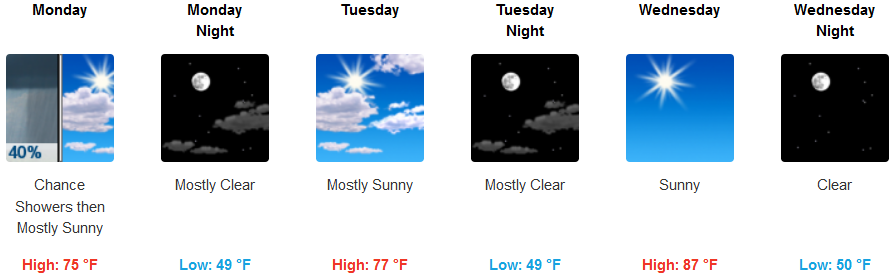
As we start the work week, chances of rain remain Monday morning decreasing as the day progresses. Temperatures inland will rise quickly after the cloud cover moves to the east while still holding the possibility of isolated showers. Temperatures are forecast to stay in the low 50’s in the mornings while reaching up to 90 degrees by the beginning of the weekend.
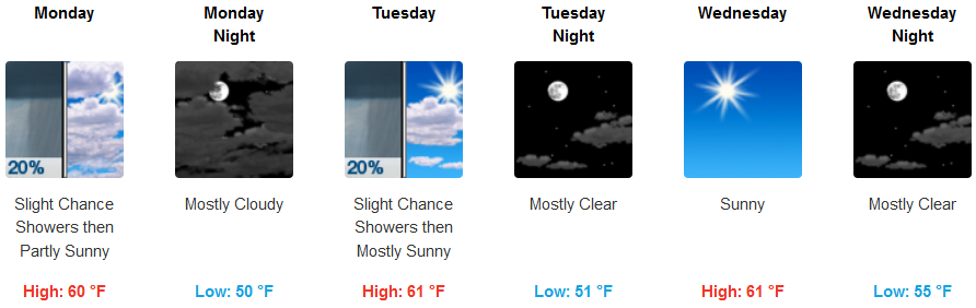
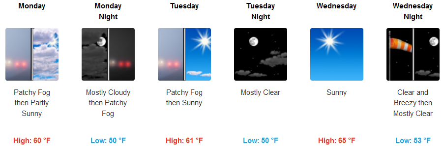
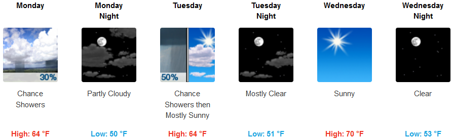
On the coast, chances of isolated showers remain as the system continues to circulate off the coast, drawing moisture from the south as it slowly migrates across the region. The chance for showers diminishes as the work week progresses and partly cloudy skies an cool temperatures are forecast going into the weekend. Temperatures will not vary much as lows hover on the low 50’s and the highs reach the low 60’s.
Brookings:
Crescent City:
Gold Beach:
Cave Junction:
Grants Pass:
Medford: