

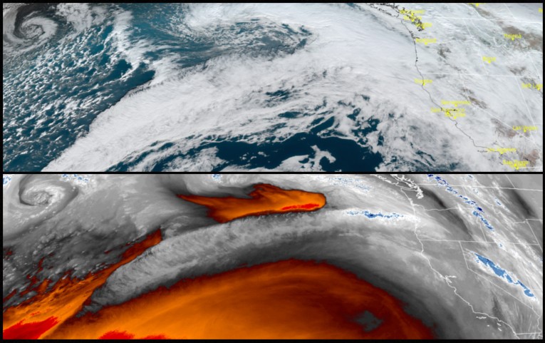
After a short break from the weather system that hammered the area Monday, an extremely active weather pattern is expected the next several days as a constant flow of moisture is expected to inundate the region with heavy rain, flooding, mountain snow and high winds as a potent storm arrives Friday into Saturday from southwestern Oregon into central and northern California through the weekend.
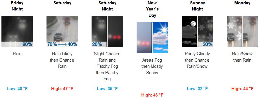
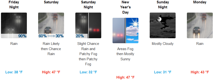
In the valley, an active weather pattern is forecast to continue into the weekend as a series of upper level weather systems make their way across the region. Snow levels are expected to remain the same before a cold front begins to shift to the south increasing heavy rain, flooding and lower snow levels southward Saturday. Temperatures will remain cool with lows in the low to mid 40’s, before colder air moves into the area, bringing colder temperatures and snow possibly after dropping to the low 30’s Saturday and into Sunday.
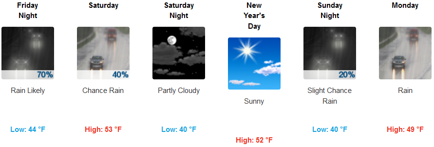
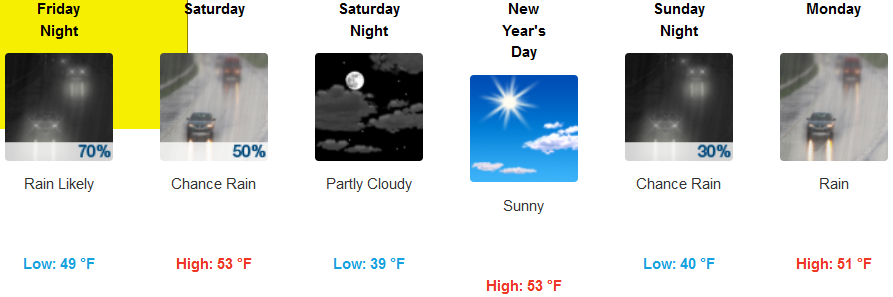
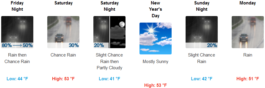
Along the coast, steady rain is forecast into Saturday, before a short break Saturday evening allows for mostly cloudy skies with some sunshine for New Years Day before rain begins to move back onshore late Sunday evening. Temperatures will remain cool with highs in the low to mid 50’s, and lows only getting to the low to mid 40’s.
Brookings:
Crescent City:
Gold Beach:
Cave Junction:
Gold Beach:
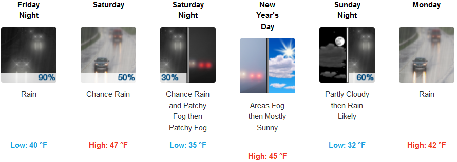
Medford: