


Resources continue to pour into the Smith River Fire Complex, now burning for ten days after first being reported Tuesday, August 15th, and has now charred 57,225 total acres and still stands at 0% containment. U.S. Hwy. 199 remains fully closed in Del Norte County from Slant Bridge Road to Oregon Mountain Road and at the Agriculture Station near the Oregon border.
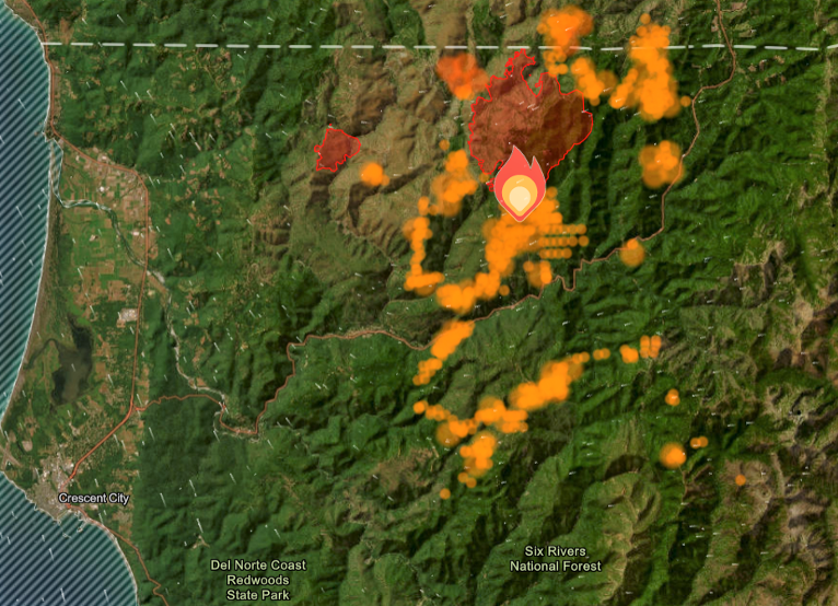
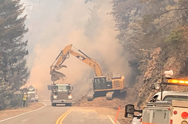
Currently assigned resources include 1655 total personnel, 26 crews, 5 helicopters, 176 engines, and 24 pieces of heavy equipment for the North, and 6 Water Tenders with more resources requested and arriving at the Smith River Complex.
Fire authorities state that weather conditions allowed air assets including helicopters and unmanned Aerial Systems to make water drops, attack hot spots and map fire perimeter. Firefighters then used this mapping data to use heavy equipment to construct fire line in areas identified as special concern.
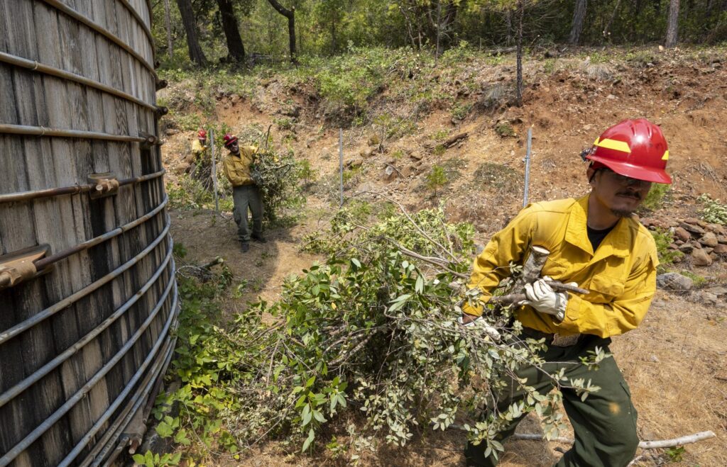
Crews are identifying structures in evacuation areas such as residences and outbuildings as fire crews work with local resources to assess and protect these structures which may include fuel mitigation such as cutting tall grasses and brush, removing low hanging limbs, stored firewood, and other materials that could fuel the fire and ignite structures.
In preparation of dynamic weather conditions forecast for Thursday afternoon and into Friday morning, all fire management agencies pre-positioned resources as fire crews have been working hard to set up structure protection around the numerous neighborhoods in and around Gasquet.
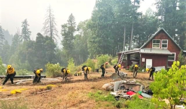
Fire authorities are planning for early detection and aggressive initial attack to keep any new starts as small as possible.These preparedness measures include setting up large fold-a-tanks full of water, hoses, pumps and sprinkler systems and heavy equipment has established dozer lines to the north of the town that will be used as the primary containment line as the fire moves south along the Stony Creek drainage.
Pacific Power announced late Thursday afternoon that it had de-energized lines for the safety of the public and emergency responders due to active wildfires. Pacific Power is in the process of providing temporary power to customers in the Crescent City area using large generators.
Community Resource Tents remain available at the Del Norte High School Parking lot including charging stations where phones, tablets, and battery back ups can be charged. These tents also include a hose system installed by the City of Crescent City to fill buckets of water.
Also, the American Red Cross has opened a shelter at the Del Norte County Fairgrounds for those who have been impacted located at 421 US-101 N, Crescent City, CA.

All evacuation orders are issued by the Del Norte County Sheriff’s Office. If you are in the Del Norte County, area please sign up for their Community Alert System to receive emergency notifications. Evacuation levels as of August 21st were
At approximately 3:00pm Thursday afternoon, the town of O’Brien received Level 3 ‘Go Now’ evacuation notices
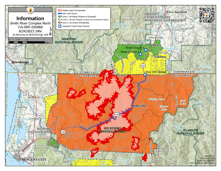
Level 3 “Go Now”: Low Divide at Highway 197 from mile marker 1 to mile marker 13. Patrick Creek, Little Jones Creek, Copper Creek Drainage, Coon Creek/ 16n19 17n07, Washington Flat, Pioneer Road, Panther Flat Campground Area, all communities between Slant Bridge Road north to the Oregon Border along Highway 199, French Hill Road.
Level 2 “Be Set”: High Divide, Rowdy Creek, Big Flat/Rock Creek
Level 1 “Be Ready”: Hiouchi from Slant Bridge to the east end of North Bank Road