

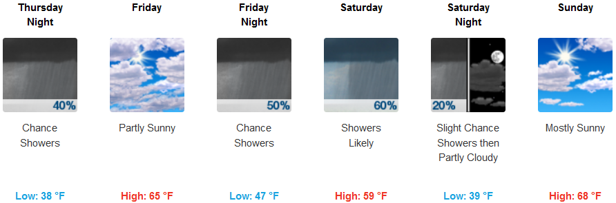
Thursday a weak low pressure system is forecast to bring a significant chance of rain to the area continuing into Friday. Another frontal system is forecast to enter the forecast region on Friday night, spreading lower elevation coastal rain and mountain snow into the region. Precipitation amounts are expected to remain under an inch.
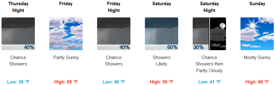
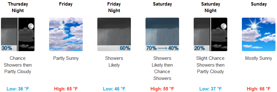
Inland, Thursday is expected to start off with moderate chances of precipitation with a possible break in the possibility of showers Friday before another system moves into the area late Friday and Saturday. Snow levels are expected to remain relatively high, above 3700 ft. with early morning lows in the upper 30’s and highs possibly reaching the mid 60’s Friday.
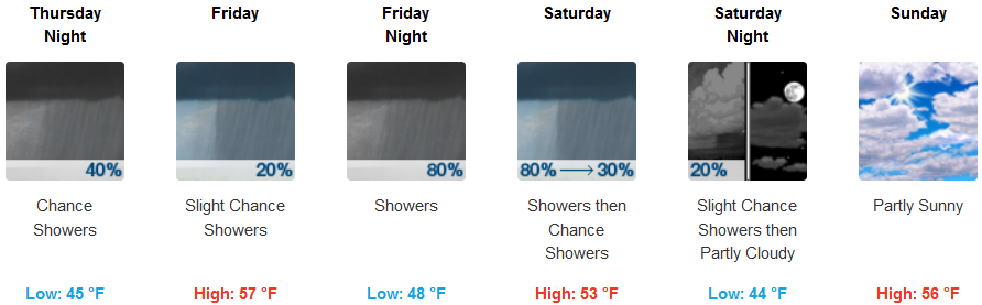
Coastal areas will experience mostly cloudy skies and showers Thursday to start the second half of the work week, continuing into the weekend, as more precipitation is expected to enter the area Friday. Temperatures will remain relatively mild with lows in the low to mid 40’s, and highs in the mid to upper 50’s for the remainder of the week.
Brookings:
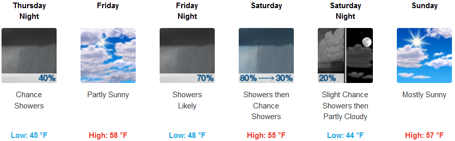
Crescent City:
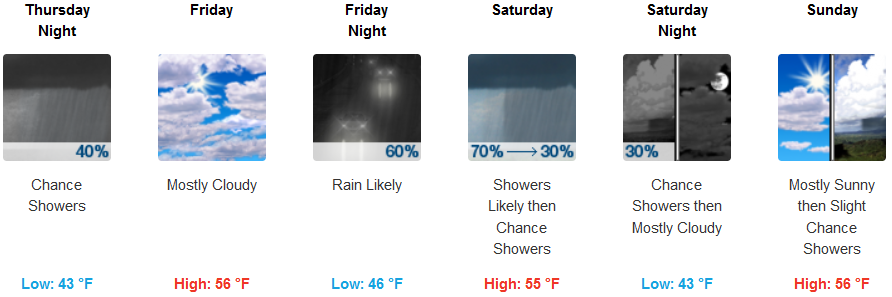
Gold Beach:
Cave Junction:
Grants Pass:
Medford: