

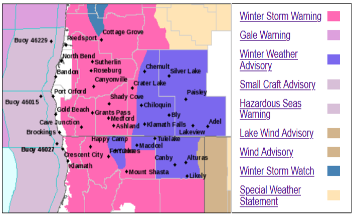
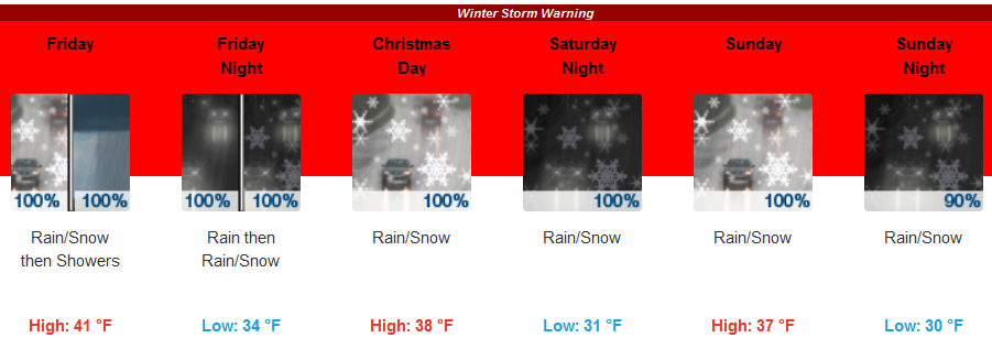
Most of southern Oregon and northern California are under Winter Storm Warnings or Advisories as a powerful winter storm system moves into the area this Christmas holiday weekend, prompting the National Weather Service to strongly discourage travel during this weekend if possible.
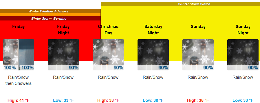
Friday, Christmas Eve, and Sunday are forecast to be the most impactful days and all area passes are expected to be affected before snow levels drop even further with precipitation slowing Saturday briefly as another system bringing heavy precipitation moves into the area Saturday, Christmas, night.
In the valley, cloudy skies are forecast keeping the temperature around 37 degrees with a light south southeast wind and rain and snow expected by the afternoon. Snow levels will drop to 1600 ft. and temperatures will continue to get colder as the holiday weekend progresses. Low temperatures through out the region are expected to be in the low 30’s to the upper teens by Monday, with high temperatures inland in the upper 30’s.
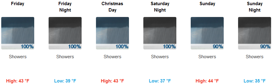
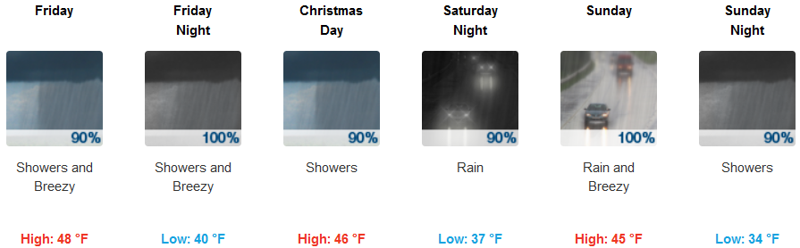
Coastal areas are forecast to see rain early Friday morning with the possibility of isolated thunderstorms as another mass of cold air pushes onshore. Rain is expected through out the holiday weekend, heavy at times with possible thunderstorms again on Saturday as an even colder air mass with heavier precipitation moves into the area. Low temperatures will be in the mid 30’s, however, snow levels could get as low as 500 ft. late Sunday evening and into Monday. High temperatures will be in the low 40’s along the coast.
Brookings:
Crescent City:
Gold Beach:
Cave Junction:

Grants Pass:
Medford: