

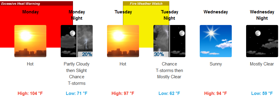
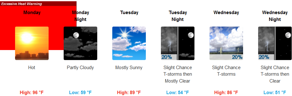
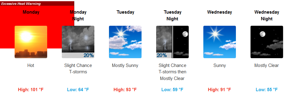
As extremely warm air circulates north from south eastern California, Excessive Heat Warnings remain in effect to start the work week before a weak trough of low pressure from the north presses into the region.
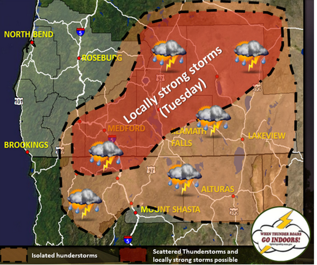
This will disrupt the strong high pressure currently over the region, resulting in the possibility of isolated to scattered thunderstorms across many inland areas Monday and Tuesday. The main threats with these thunderstorms will be gusty winds, small hail and dangerous lightning.
Inland areas are forecast to see temperatures in the triple digits Monday, continuing into Tuesday before temperatures begin to cool as thunder and lightning storms move into the region. Temperatures are expected to cool to the mid 90’s as the work week progresses, with evening and morning temperatures getting as low as the mid 50’s by mid week.
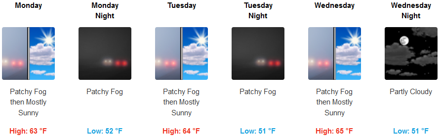
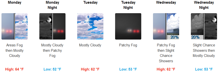
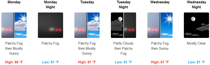
On the coast, the marine layer will keep the coast cool for the work week with fog in the usual areas in the mornings and sunny afternoons. Temperatures are forecast to be in the low to mid 50’s in the mornings with fog, and sunny partly cloudy skies in the afternoon with temperatures reaching the mid 60’s.
Brookings:
Crescent City:
Gold Beach:
Cave Junction:
Grants Pass:
Medford: