

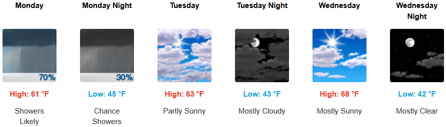
Unsettled weather is expected to continue into the work week as the passing cold front responsible for the rain and thunderstorms late Sunday, continues to generate showers and thunderstorms inland through Monday before partly cloudy skies return Tuesday.
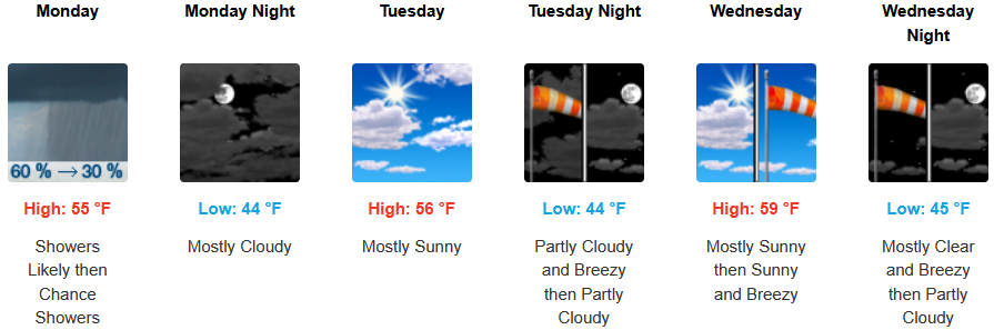
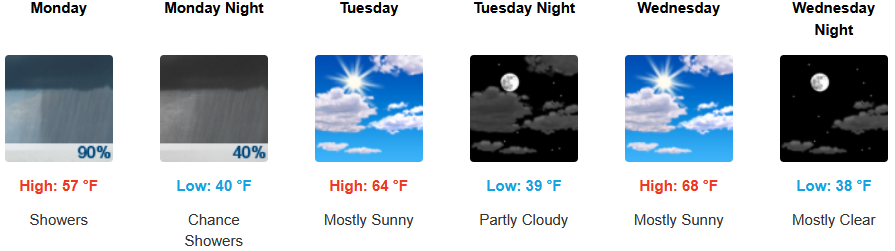
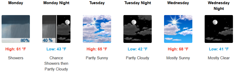
Rain and showers are expected inland to with gusty winds up to 15mph through Monday before increasing before partly cloudy skies return into mid week. Lows are expected to be in the low to mid 40’s, with highs reaching the mid to upper 60’s by Wednesday.
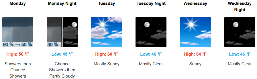
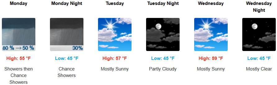
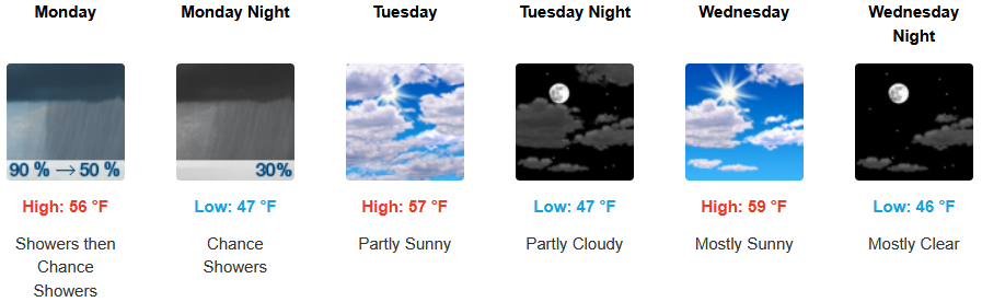
Along the coast, Sunday’s rain system is expected to continue with wind gusting up to 20mph through Monday before partly cloudy skies return into mid week. Afternoon highs are expected to range from the low 50’s Monday to the mid 60’s mid week, with morning lows cooling to the mid 40’s.
Brookings:
Crescent City:
Gold Beach:
Port Orford:
Cave Junction:
Grants Pass:
Medford: