

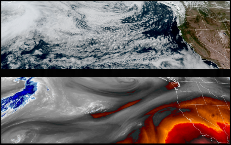
Mostly clear sunny skies and warm temperatures are forecast to be short lived as a strong low pressure system moves into the region driving a cold front that is expected to bring cooler temperatures, wind, and significant chances for precipitation starting as early as Friday and continuing into Sunday.
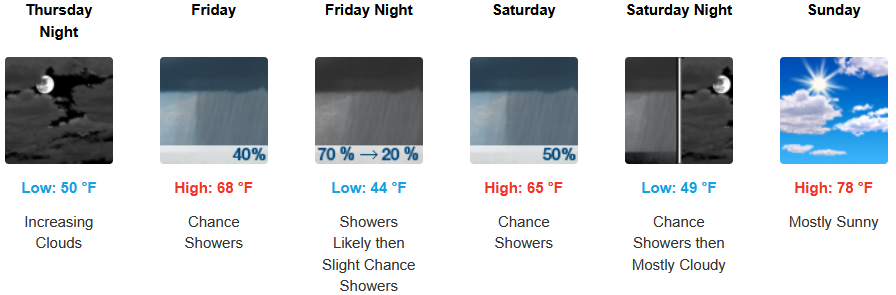
Inland areas are forecast to increasing clouds Thursday with a northwest wind that could gust to 20mph and a chance of showers starting early Friday afternoon and showers likely clearing Sunday. After Thursday, afternoon highs are expected to reach the mid to upper 60’s before warming Sunday to the upper 70’s with morning lows forecast to be in the mid to upper 40’s.
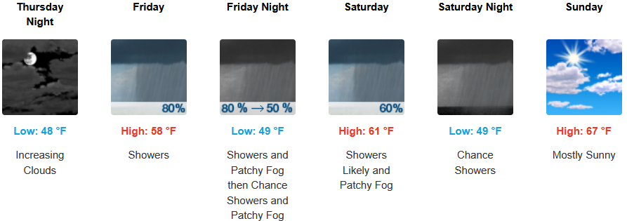
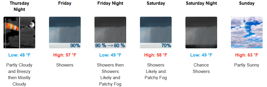
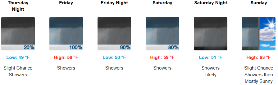
Along the coast, partly cloudy skies will start Thursday, increasing into Friday with winds possibly gusting to 30mph before significant chances for precipitation move in Friday through Saturday evening, clearing Sunday. A chance of morning fog along the immediate coast is expected with afternoon highs forecast to reach the upper 60’s, with morning lows cooling to the upper 40’s.
Brookings:
Crescent City:
Gold Beach:
Port Orford:
Cave Junction:
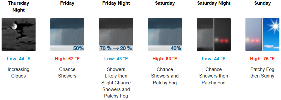
Grants Pass:
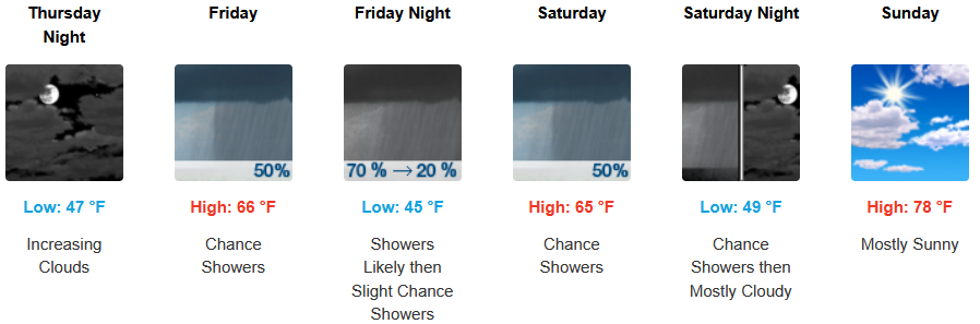
Medford: