

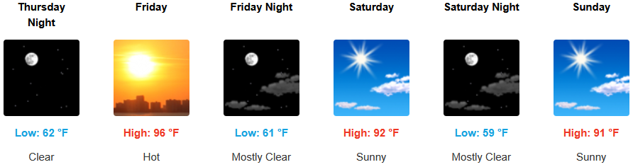
The ridge of high pressure responsible for the warm temperatures has begun its move to the east and the recent heat wave is beginning to wane, however, the mostly clear, sunny skies are expected to continue across the region through the weekend.
Inland areas will continue to see mostly sunny skies, but the triple digit temperatures will begin to cool slightly through the end of the workweek. Afternoon highs are expected to climb to the high 90’s with little relief overnight with lows forecast in the upper 60’s.
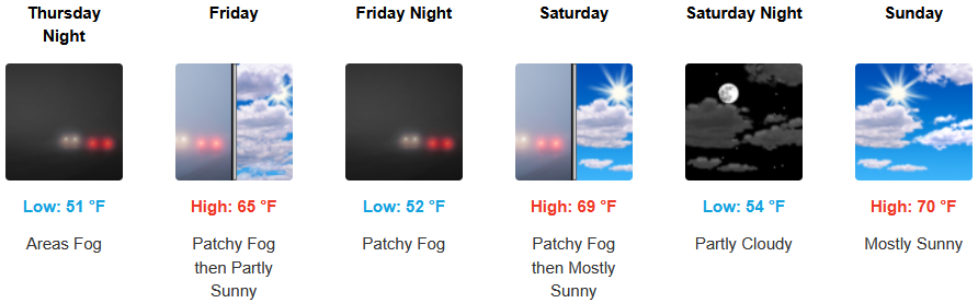
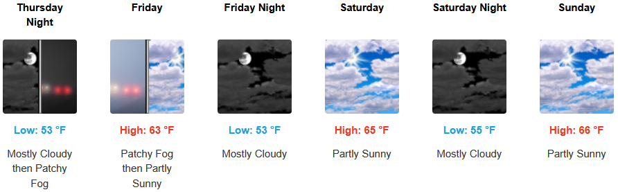
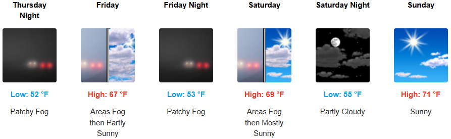
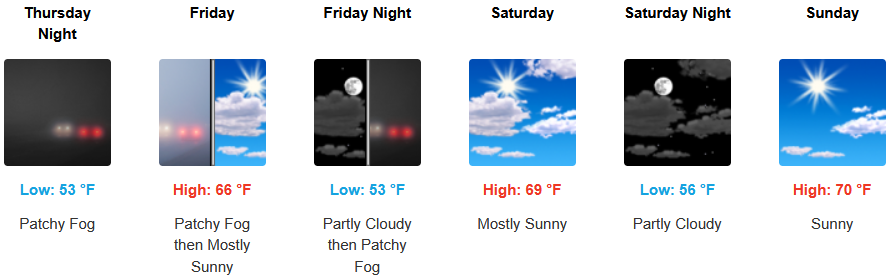
Much of the same is forecast along coastal areas with temperatures forecast to continue to be warm under mostly clear skies into the weekend. A continued morning marine layer along the immediate coast and localized areas of morning fog under mostly sunny afternoon skies are expected through the weekend. Temperatures could reach the low 70’s for highs in some areas with morning lows in the low to mid 50’s.
Brookings:
Crescent City:
Gold Beach:
Port Orford:
Cave Junction:
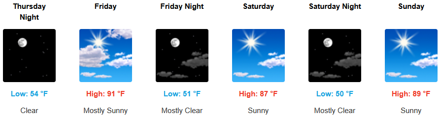
Grants Pass:
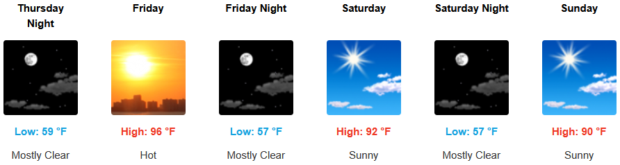
Medford: