

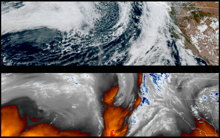
As the first of two relatively well organized low pressure systems moved ashore Sunday, fall like wet and windy weather is expected to pass through the area beginning late Sunday through Monday.Widespread wetting rains are expected across the area with gusty winds and with stronger winds along the coast, and over high terrain.
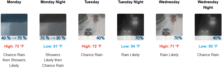
Inland areas can expect high winds late Sunday evening into Monday with rain forecast through mid week. Afternoon highs are expected to be in the low 70’s through mid week, with lows forecast to be in the low 50’s.
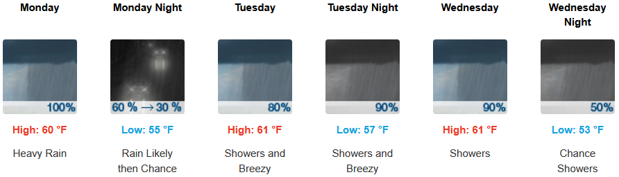
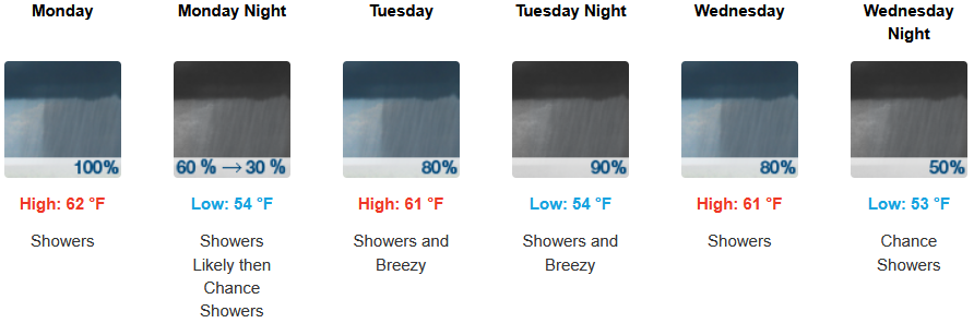
Coastal areas are forecast to see showers and possible thunderstorms begin as early as late Sunday evening and Monday morning in some areas. Temperatures are forecast to be in the low to mid 70’s for highs dropping to the mid 60’s by Sunday with morning lows in the 50’s.
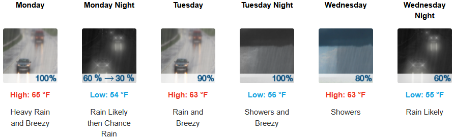
Brookings:
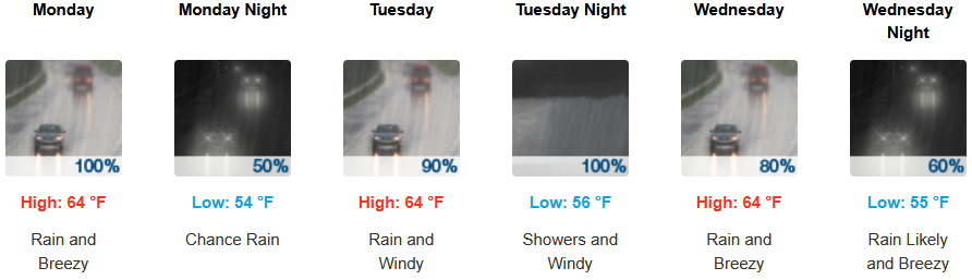
Crescent City:
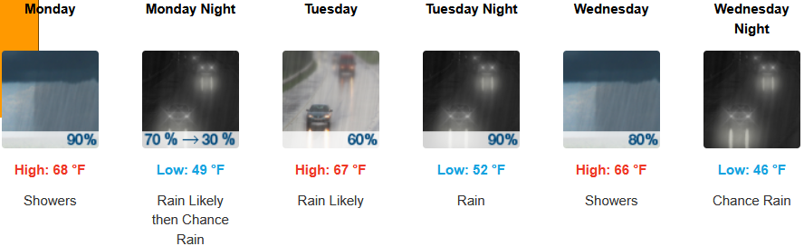
Gold Beach:
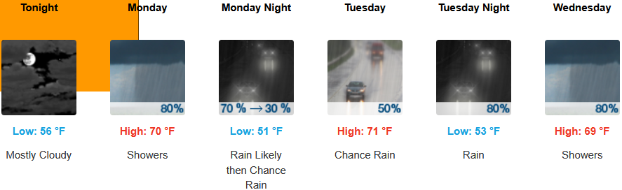
Port Orford:
Cave Junction:
Grants Pass:
Medford: