

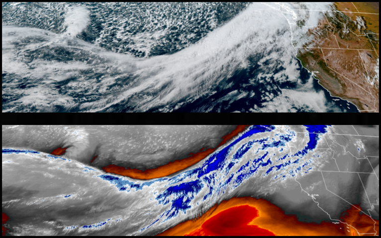
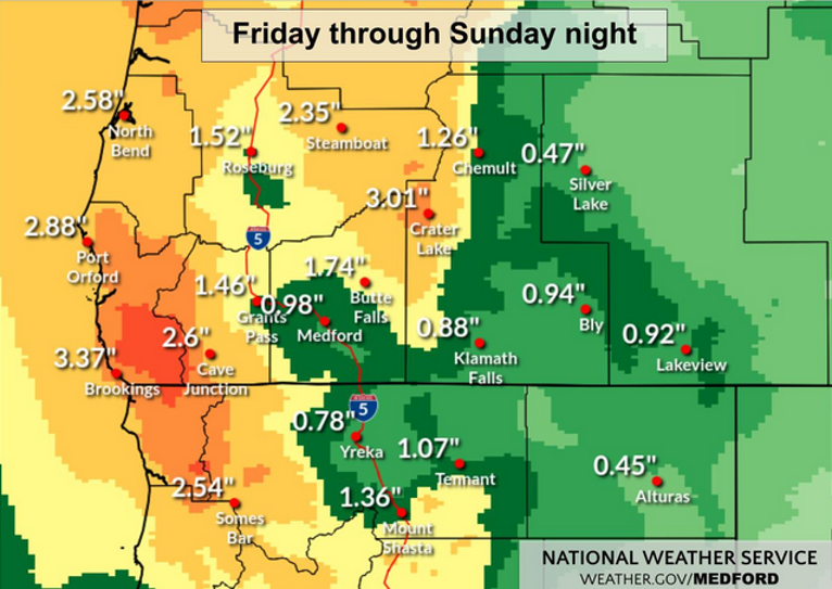
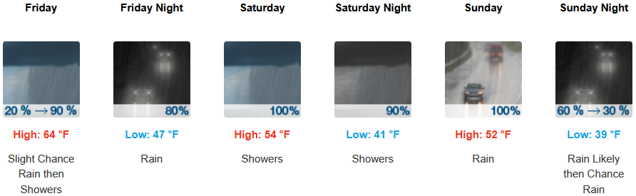
A series of several storm systems are forecast to bring periods of moderate to heavy rain Friday through Sunday with the heaviest rain expected for Coos, Curry, Douglas, and Josephine counties and High Wind Warnings issued by the National Weather Service primarily for the coast, extending from Nesika Beach, to the north, and as far south as Eureka, California.
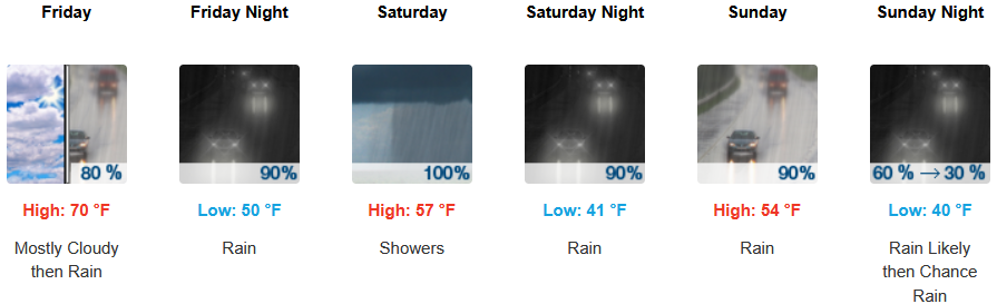
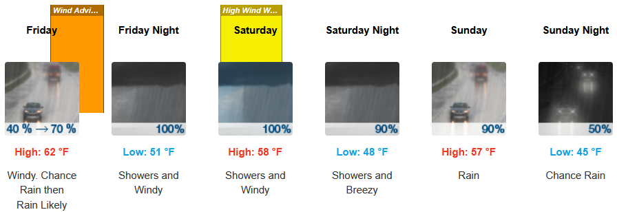
Inland areas are forecast to see rain beginning Friday afternoon with east wind gusts up to 20mph continuing into and through the weekend. Afternoon highs are expected to start in the upper 60’s, dropping to the low to mid 50’s as the weekend progresses, with lows forecast to be in the mid 40’s.
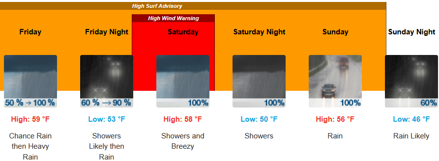
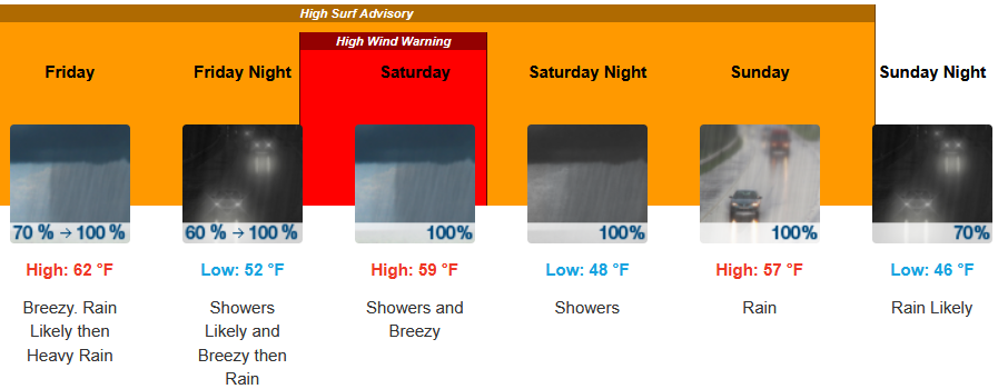
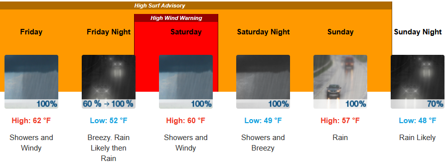
Along the coast, High Surf Advisory’s and High Wind Warnings have been issued by the National Weather Service through the weekend with rain starting as early as early Friday morning. Temperatures are forecast to reach the upper 50’s for highs in some areas, with morning lows in the upper 40’s.
Brookings:
Crescent City:
Gold Beach:
Port Orford:
Cave Junction:
Grants Pass:

Medford: