

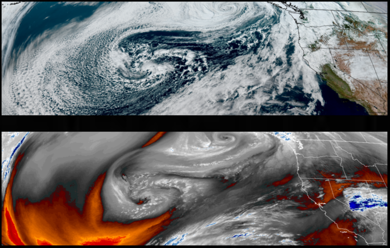
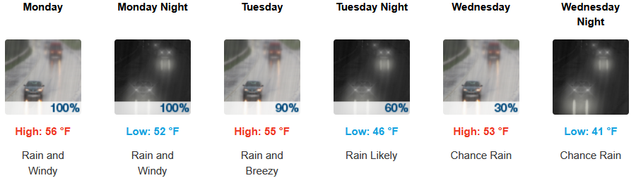
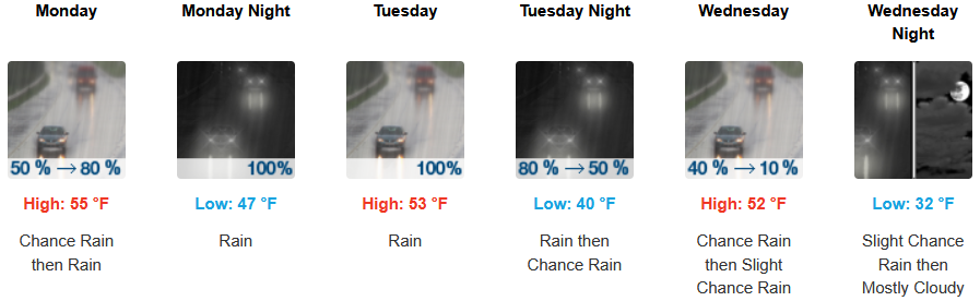
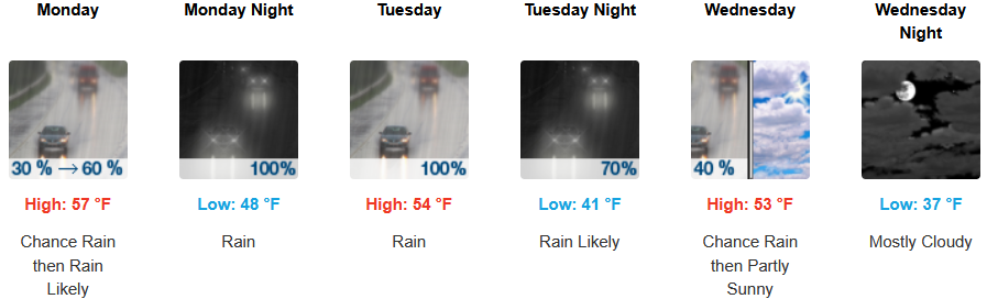
The low pressure system that has brought the recent weather pattern has moved to the north east, however, it continues to circulate unstable air and weather systems across the region. Warmer air is expected to continue to push bands of precipitation, heavy at times, across the region with snow levels rising to 6,000′.
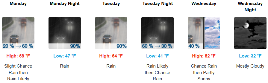
Inland areas can expect rain, or chances of rain into midweek as a warmer air mass moves over the area with snow levels at the highest passes. Afternoon highs are expected to be in the mid 50’s to start the workweek, with lows forecast to be in the low to mid 40’s through mid-week.
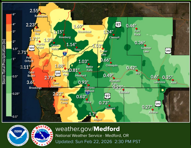
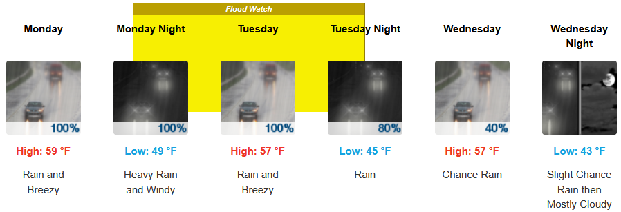
Along the coast, onshore flow off the Pacific will continue to produce rounds coastal rain, heavy at times, as a warmer air-mass moves onshore. Temperatures are forecast to start the week in the mid 50’s rising to the mid 50’s for high’s as the week progresses, with morning lows starting in the mid 40’s.

Brookings:

Crescent City:
Gold Beach:

Port Orford:
Cave Junction:
Grants Pass:
Medford: