

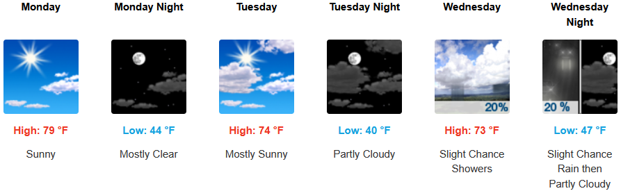
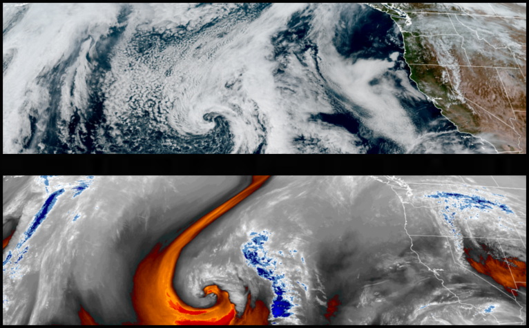
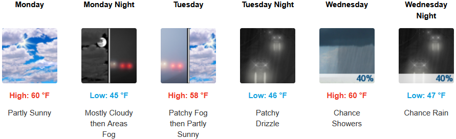
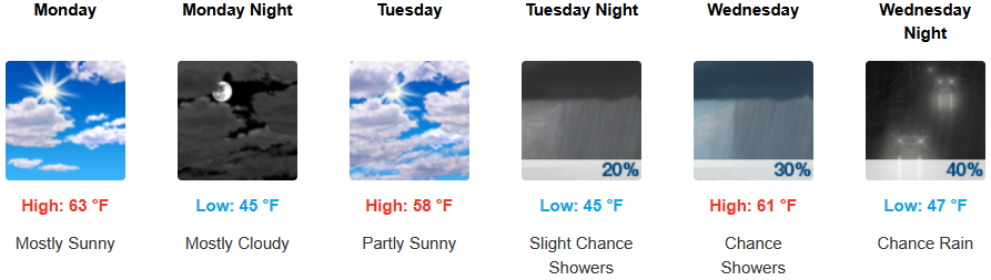
The dry and relatively warm weather pattern over the weekend, is expected to continue to start the workweek with mostly sunny skies into midweek before significant chances of precipitation return to the forecast as early as Wednesday morning.
Mostly clear skies and warm afternoon temperatures are expected to continue for inland areas into midweek before another low pressure system moves over the region with chances of rain starting early midweek. Afternoon highs will start the week in the low 80’s dropping to the 70’s by midweek, with lows forecast to be in the low to mid 40’s.
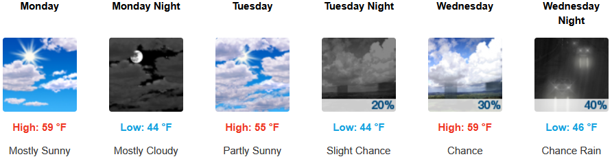
Along the coast, partly cloudy skies start the week, before increasing clouds begin to move onshore early Tuesday with chances of showers as early as very early Wednesday morning. Highs are expected to be in the low to mid 60’s, with lows forecast to be in the mid to upper 40’s.

Brookings:

Crescent City:
Gold Beach:
Port Orford:
Cave Junction:
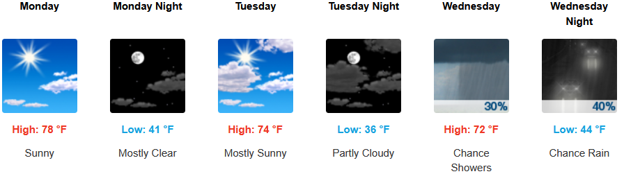
Grants Pass:
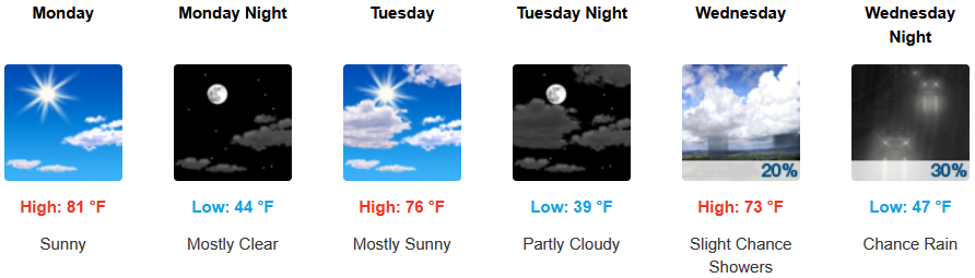
Medford: