

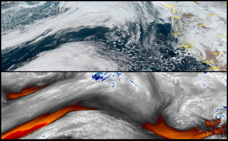
After a long series of wet and windy storm systems relentlessly pummeled the west coast for weeks, a change in the weather pattern will bring drier and colder air into the region after a quick moving front pushes onshore Tuesday.
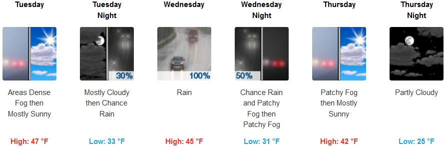
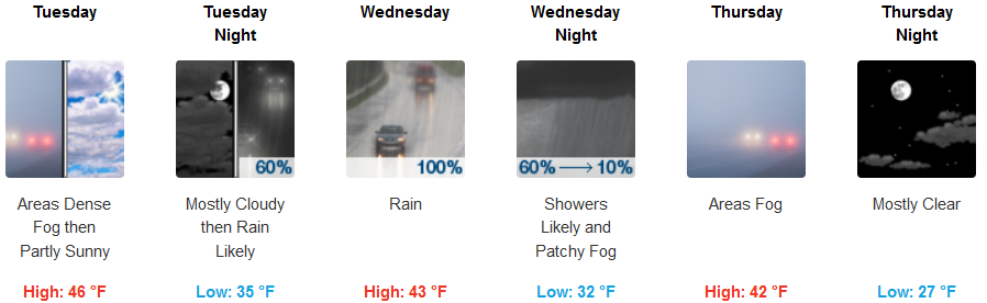
Inland valleys are forecast to see overnight and early morning fog and freezing fog in some locations, after a fast moving front moves inland, dropping temperatures significantly along with snow levels possibly falling as low as 2000ft. before moving to the southeast. Temperatures across inland areas will see afternoon highs only reach the mid 40’s, with lows dropping as low as the mid 20’s by the end of the week.
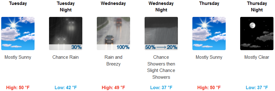
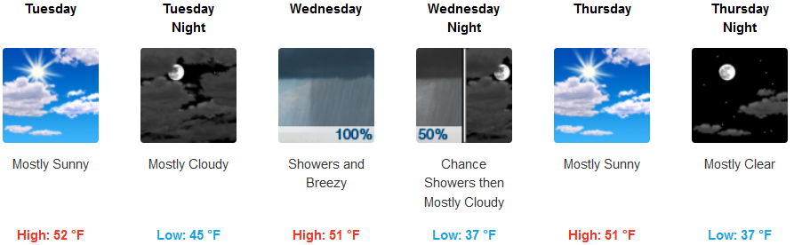
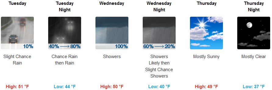
Along the coast, Tuesday is expected to be mostly sunny for much of the day with chances of rain developing earlier in the day along the coast as you travel north. Precipitation is expected early Wednesday morning bringing the possibility of thunder showers late Wednesday as colder air moves into the region. High temperatures along the coast will reach the upper 40’s throughout the workweek with lows in the upper 30’s.
Brookings:
Crescent City:
Gold Beach:
Cave Junction:
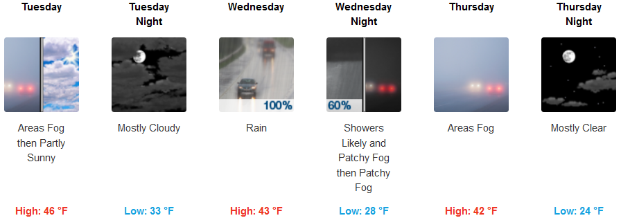
Gold Beach:
Medford: