

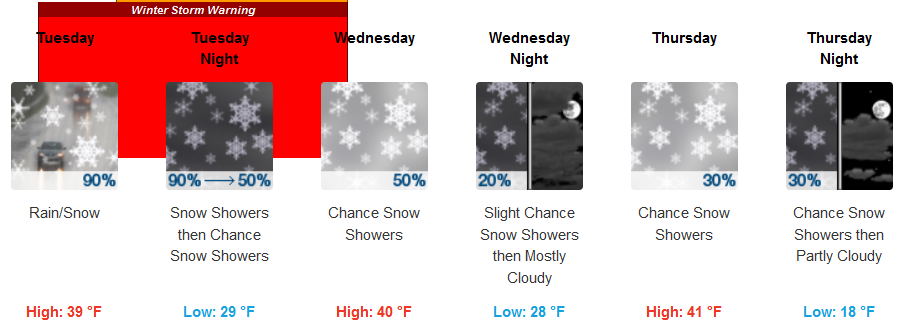
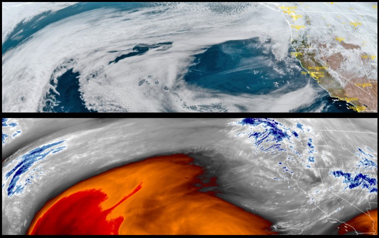
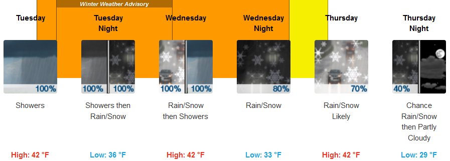
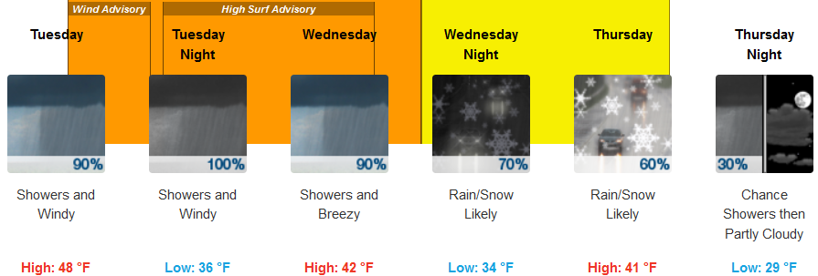
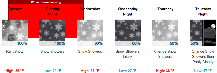
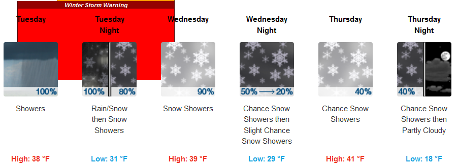
A significant change in the weather pattern is forecast across much of southern Oregon and northern California as a cold front begins to move through area Monday night and Tuesday, followed by precipitation and a colder air mass Tuesday night and Wednesday. The potential for low elevation snow as well as heavy snow across higher elevations has prompted the National Weather Service to issue Winter Storm Warnings and Winter Weather Advisories all across southern Oregon and northern California from the coast to inland valleys.
Inland, snow levels are forecast to quickly lower from 4000-5000 ft Monday night to 1500-2000 ft late Tuesday morning and afternoon. Snow impacts are possible down to lower passes on Tuesday, continuing through Wednesday morning with light to moderate accumulations of 1 to 4 inches of snow as levels fall to lower valley floors (500 ft). High afternoon temperatures are expected to only reach the low 40’s, however, inland lows are expected to be in the mid 20’s, possibly dropping into the teens by Thursday.
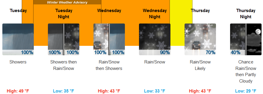
The National Weather Service has issued a Winter Weather Advisory for much of the southern Oregon and northern California coastline as a cold front followed by precipitation is forecast to possibly impact coastal and coastal mountain areas with hail showers and snow across many coastal ridges and valleys. Rain will begin very early Tuesday morning, with the possibility of thunderstorms as the cold front moves on shore. Temperatures will remain in the mid 40’s early in the week before dropping to the upper 20′ to low 30’s later in the work week.
Brookings:
Crescent City:
Gold Beach:
Cave Junction:
Grants Pass:
Medford: