

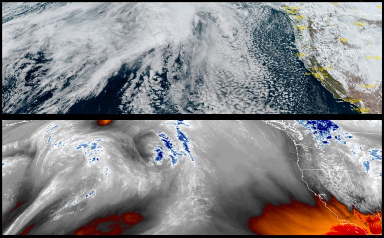
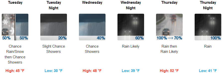
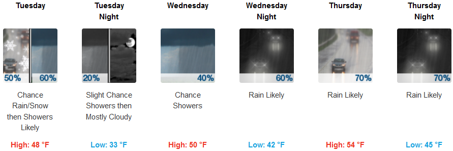
A weak trough moving down from the north will usher in cold unstable air over southern Oregon as the work week progresses. Showers continue with low snow levels possibly reaching west side valley floors Tuesday morning. Lingering showers are expected to dissipate, however chances of showers and snow showers are forecast through out the week.
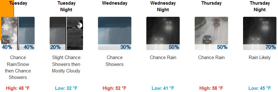
Inland areas can expect a chance of snow showers before noon Tuesday, changing to mostly cloudy skies with a chance of rain showers continuing through the week and light winds if any. Temperatures are expected to cool even more starting Tuesday afternoon dropping snow levels to approximately 2000ft. Wednesday morning before a warming trend brings low temperatures up to the low to mid 40’s with highs getting to the upper 50’s later in the week.
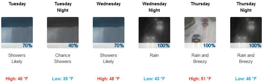
A weak trough pushing onshore is forecast to create continued, sometimes localized periods of coastal precipitation and possibly heavy rain Wednesday and into Thursday with accumulations of up to three quarters to an inch of rain possible. Temperatures are expected stay in the upper 30’s for lows along the coast with highs getting into the mid 50’s later in the week.
Brookings:
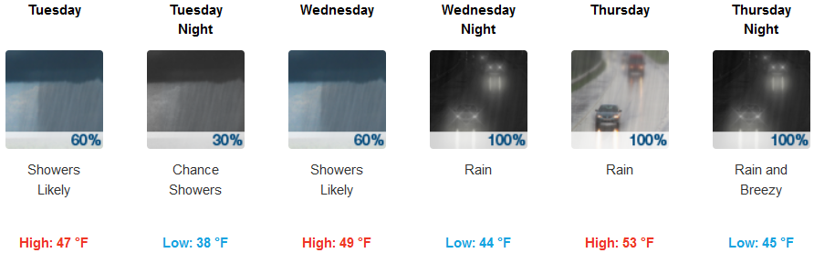
Crescent City:
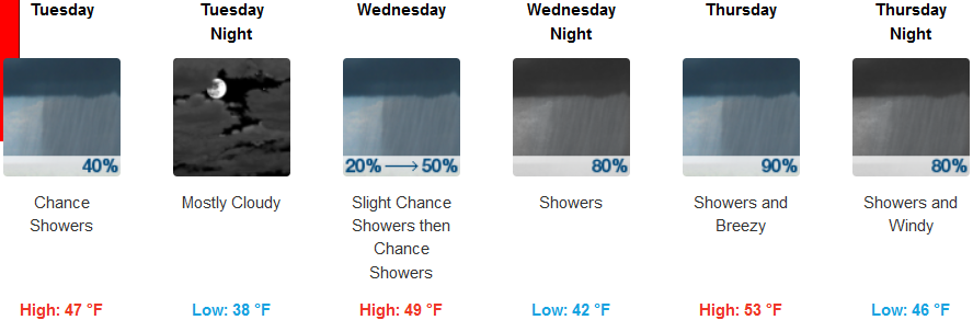
Gold Beach:
Cave Junction:
Grants Pass:
Medford: