

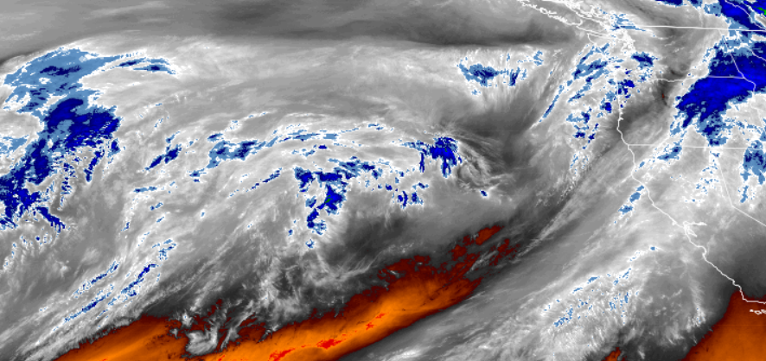
Mostly dry conditions over Thanksgiving Day across much of southern Oregon will give way to a developing pattern of moisture that is expected to bring more moderate to heavy precipitation to northern Oregon and Washington.
High pressure developing in California is pushing into the southern Oregon region, however, the area could see the bottom edge of this system Friday and into Saturday with a 50% chance of precipitation in the area. Temperatures associated with this sub-tropical moisture are relatively warm, keeping snow levels high, and should not impact end of Thanksgiving holiday travel.
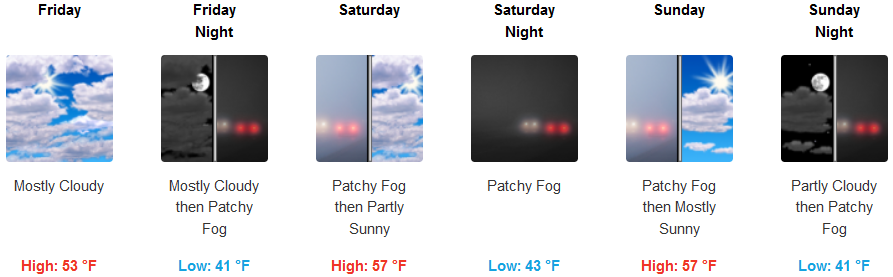
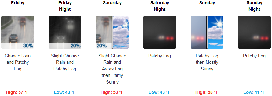
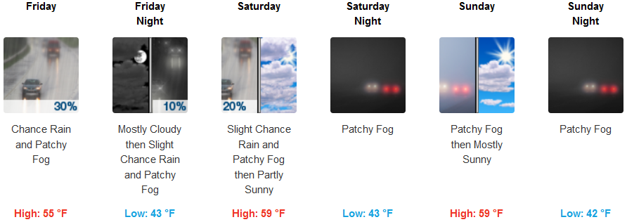
With high pressure aloft from the south pushing the majority of possible rain to the north, inland areas such as Cave Junction and Grants Pass have slight chances of seeing precipitation with chances decreasing traveling south. Persistent night and morning fog will start most days with partly cloudy skies by late weekend. Temperatures will range from low to mid 40’s, to highs in the low 60’s.
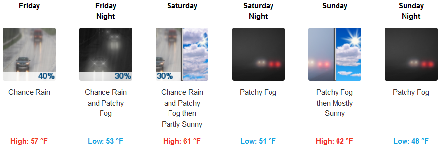
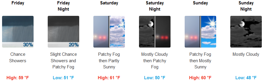
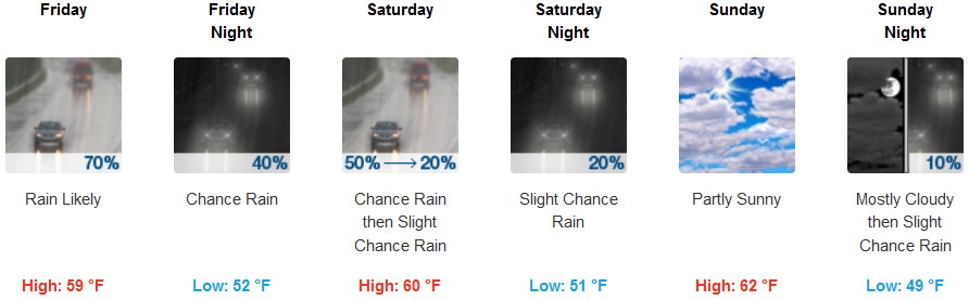
Coastal areas are forecast to see mostly cloudy skies with chances of precipitation increasing from 20% to 30% as south as Crescent City, increasing as you travel north with 60% to 70% chances of rain in Gold Beach through Saturday. Temperatures along the coast will be warm, ranging from early morning lows in the low to mid 40’s, to highs in the low 60’s.
Brookings:
Crescent City:
Gold Beach:
Cave Junction:
Grants Pass:
Medford: