

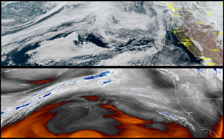
Unsettled weather with slight chances of localized showers are forecast to continue with a very weak front moving onshore late Friday and early Saturday, before another system moves into the region Sunday, producing coastal rain.
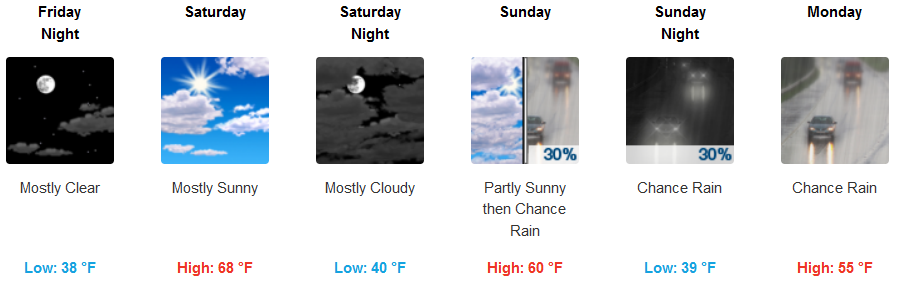
Inland areas can expect partly cloudy to mostly sunny skies through Saturday, with increased cloudiness accumulating Sunday and a rain expected Sunday afternoon. Some areas could see morning frost as temperatures dip into the mid 30’s for lows, with highs in the low to mid 60’s into Saturday, dropping to the mid 50’s Sunday and Monday.
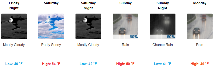
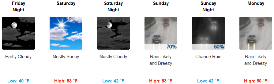
Coastal areas will continue to see mild weather with mostly clear sunny skies and relatively warm temperatures into late Saturday before a system begins to move onshore Saturday night bringing significant chances for rain Sunday and into Monday. Temperatures will be chilly along the southern coast with lows warming from the mid 30’s and highs remaining in the low to mid 50’s.
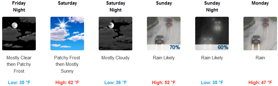
Brookings:
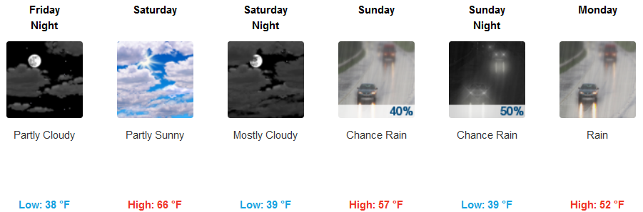
Crescent City:
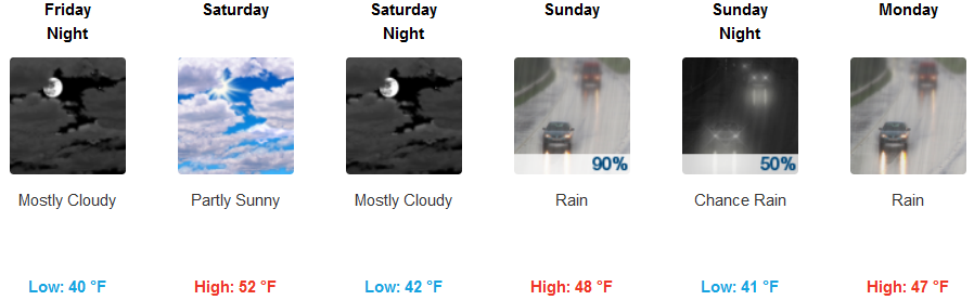
Gold Beach:
Cave Junction:
Grants Pass:
Medford: