

Weather will continue to feel more like summer through the weekend, even though autumn ushered itself in on Wednesday, as temperatures in the 80’s and 90’s inland are forecast for the end of the work week and in the 80’s closer to the coast.
Temperatures are forecast to slightly cool off over the weekend as the trough of high pressure moves out of the area, and a new front of low pressure begins to cool temperatures before bringing the next chance of much needed rain.
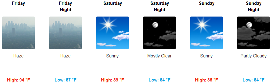
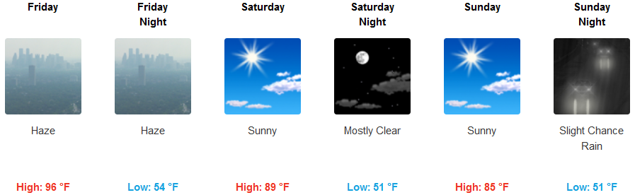
Inland, mostly clear skies will continue to be hazy with localized smoke impacts from surrounding wildfires, however, as the work week winds down, a new trough of low pressure will push the haze out of the area ahead of increased cloudiness bringing the possibility of precipitation by late Sunday evening. Temperatures in the valley gradually cool from the mid to upper 90’s in some areas to the low 80’s, with lows in the mid 50’s.
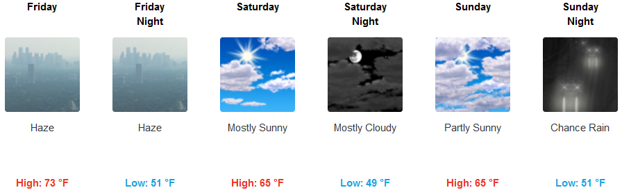
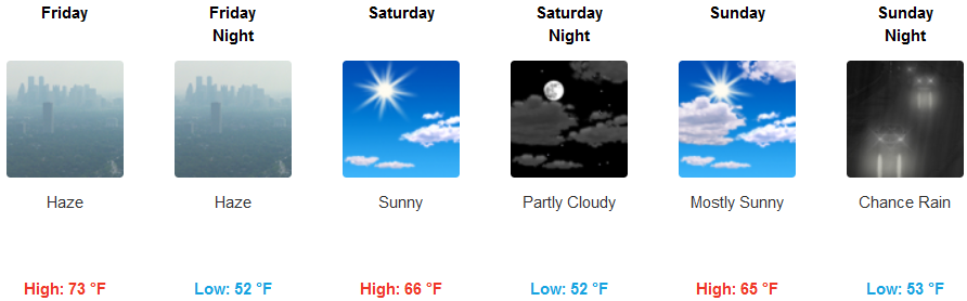
Along the coastal areas, expect haze over the area through Friday, slowly dissipating as low pressure moves into the area. Cloudy skies are forecast to begin to build Sunday, with the possibility of showers as early as late Sunday evening. Temperatures along the coast are expected to be much cooler beginning Saturday, with highs in the mid 70’s and early morning lows in the upper 40’s.
Brookings:
Crescent City:
Gold Beach:
Cave Junction:

Grants Pass:
Medford: