

A stubborn upper level trough continues to slowly move eastward, however, it will also continue to bring increasing chances for thunderstorms inland through the work week.
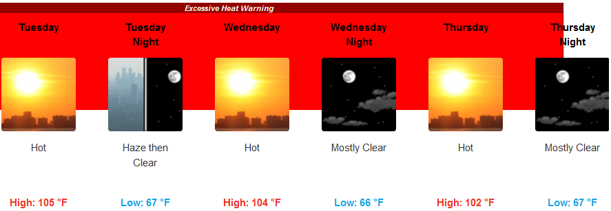
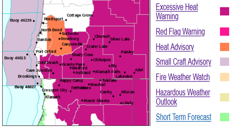
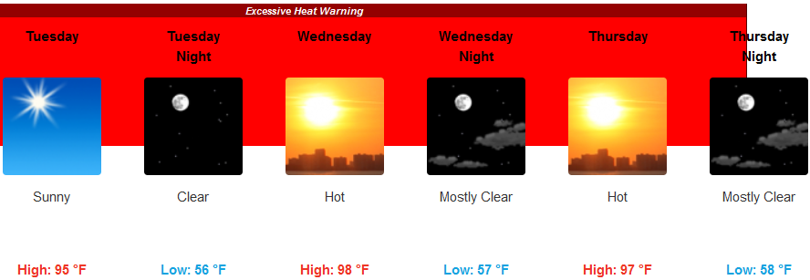
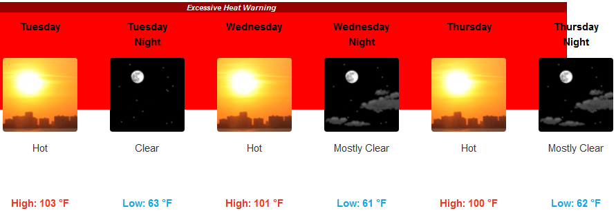
The extremely high temperatures that broke many long standing records across the are will also continue, as Excessive Heat Warnings issued by the National Weather Service remain in effect through Thursday.
Inland Excessive Heat Warnings remain with temperatures well above triple digits with little relief in the evenings. High temperatures are forecast to reach 105 degrees and could reach higher in isolated areas. Lows are expected to be in the upper 60’s to 70 degrees.
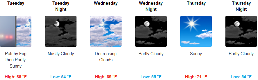
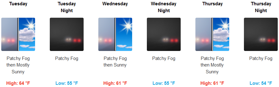
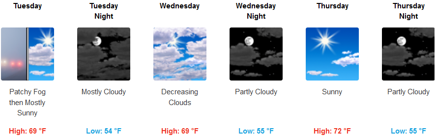
On the coast, the marine layer will continue to keep the region cool, with localized fog and misty mornings leading to partly cloudy skies and sunny afternoons. Temperatures are expected to drop into the mid 50’s with highs only getting to the low 70’s.
Brookings:
Crescent City:
Gold Beach:
Cave Junction:
Grants Pass:
Medford: