


The coldest air mass so far this winter season is expected to move over the area Sunday night and remain in place until at least Wednesday morning. Right now, we’re expecting the coldest temperatures to occur Tuesday morning.
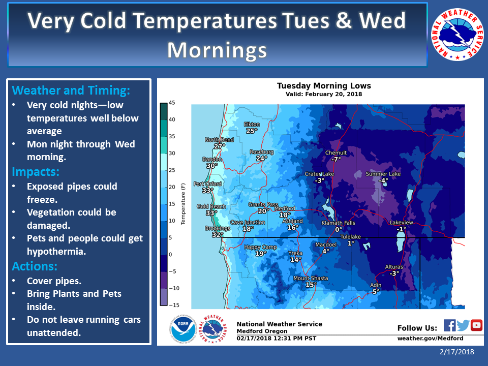
This will be due to a combination of clear skies, light winds, and a fresh snowpack. There is also a chance for record lows to be broken Tuesday and/or Wednesday mornings.
Even the coast will not be immune to the cold temperatures. Given how cold it will be, it’s highly recommended you do the following: Cover or insulate any exposed pipes as they could freeze and burst. Wear protective clothing to prevent hypothermia and frostbite. Keep pets inside and provide cover to livestock. Check on the elderly. Check on the homeless as prolonged exposure to very cold temperatures could be dangerous.
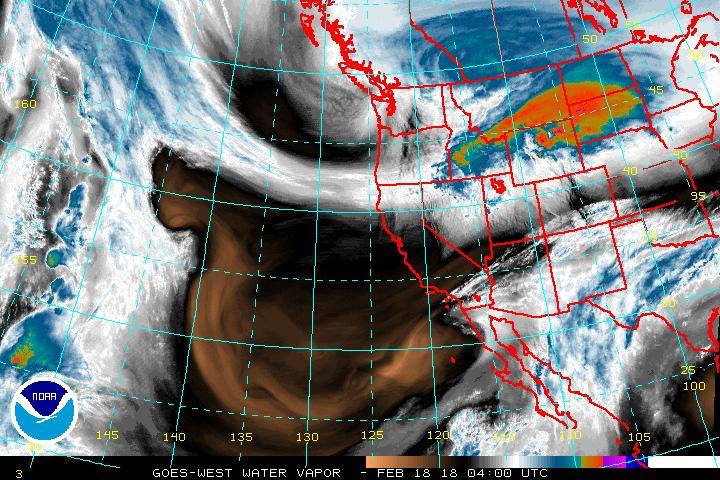
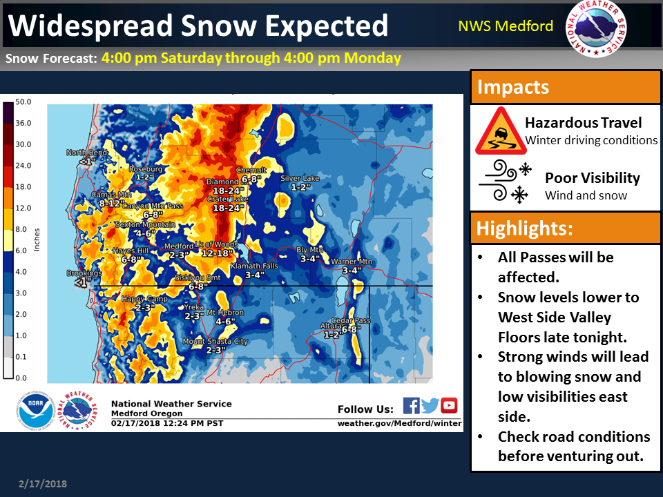
Here are some updated graphics about the system coming through late tonight through Monday. Snow levels will fall to west side valley floors by early Sunday morning and likely down to the beaches by Sunday night.
Be sure to check road conditions before venturing out. Once this system clears out, frigid temperatures will follow through Wednesday morning.
Please Like, Share and Follow the …
![]()