

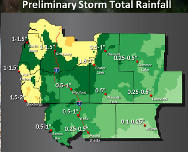
Cooler temperatures are expected later this week with rains spreading into the area Friday night and Saturday. Storm total rainfall through the weekend is expected to reach 2″ in some areas as a significant fall-like frontal system moves over much Oregon and northern California late this week.
Rain is forecast for the vast majority of the area along with some gusty winds preceding the front. These winds and continued dry humidity will result in elevated fire weather concerns at times through Friday.
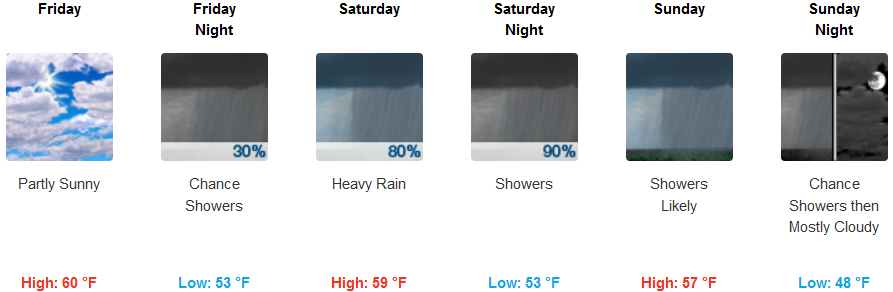
Rainfall will be moderate to heavy at times along the coast and into the Umpqua Basin Friday night into Saturday with showers continuing into Sunday as the front will pushes inland Saturday, continuing Saturday night into Sunday. Showers will persist with unstable air behind the front into Sunday afternoon, but largely end Sunday night into Monday.
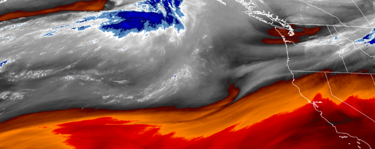
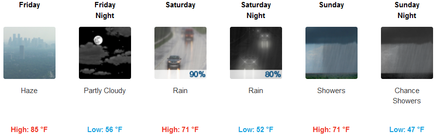
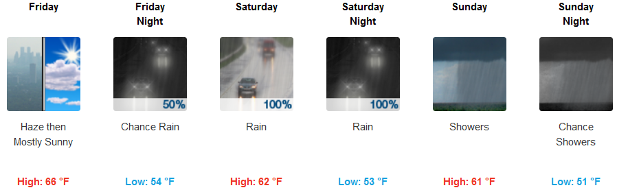
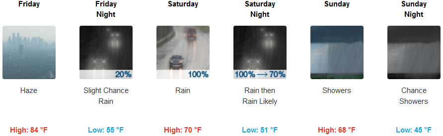
Inland Thursday and Friday will start out with continued smoke from surrounding wildfires before winds pick up late Friday and push the smoke out of the area before increasing clouds move into the area Friday morning. Rain could be heavy at times with 1″ of rain possible in some locations inland. Temperatures will cool significantly from the mid to upper 80’s earlier in the week, to the low 70’s by Sunday. Lows will be cooler at higher elevations dropping to the mid 40’s with the valley holding lows in the low 50’s.
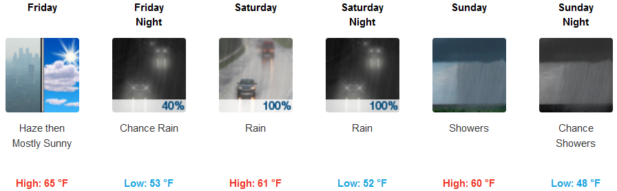
Coastal areas will see significant precipitation with amounts forecast to reach 2″ in some localized areas beginning late Friday evening, early Saturday morning. Thursday and Friday will start with hazy skies from surrounding wildfires before northwest winds gusting to 20 mph clearing skies before ushering in a cold front. Temperatures will cool to the upper 50’s along the coast and lows will stay in the upper 40’s.
Brookings:
Crescent City:
Gold Beach:
Cave Junction:

Grants Pass:
Medford: