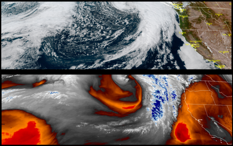


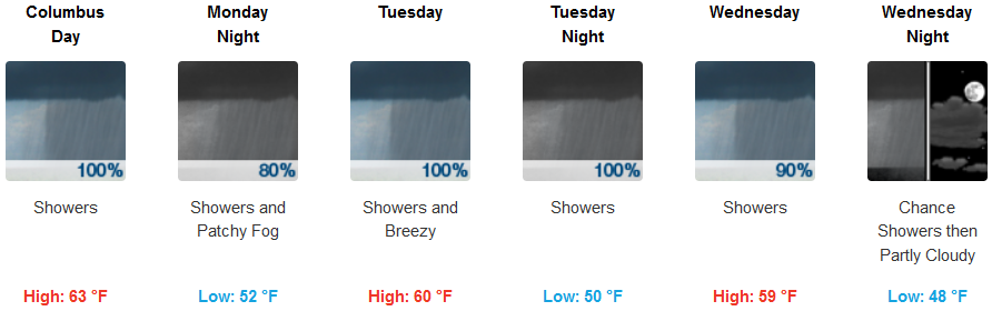
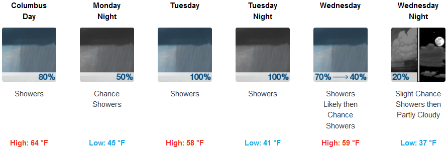
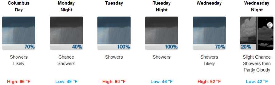
A cold front began moving onshore Sunday and is forecast to bring light to moderate precipitation to northern California and southern Oregon for much of the work week.
Inland areas can expect rain Monday morning dissipating as the evening progresses before another cold front behind it moves into the region Tuesday and into Wednesday. Temperatures are expected stay in the mid 60’s for afternoon highs with lows dropping into the mid to upper 40’s.
Along the coast locally heavy rainfall could occur as the cold front pushes into the coastal mountains bringing precipitation through the work week. Temperatures will cool as the week progresses with coastal lows ranging in the mid 40’s to low 50’s and afternoon highs getting to the upper 50’s.
Brookings:
Crescent City:
Gold Beach:
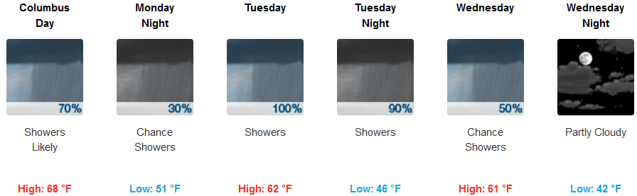
Cave Junction:
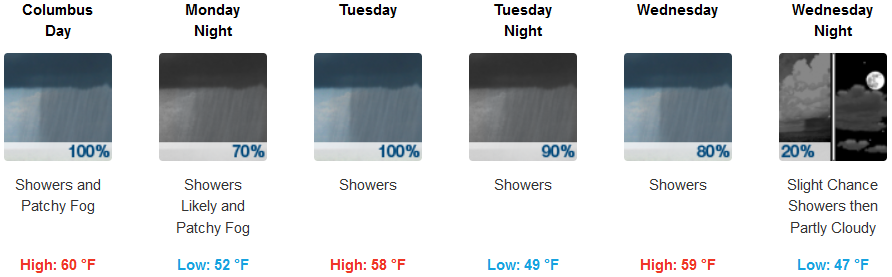
Grants Pass:
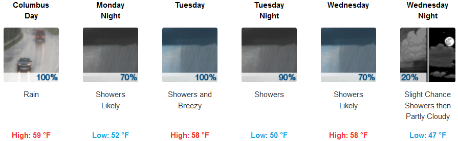
Medford: