

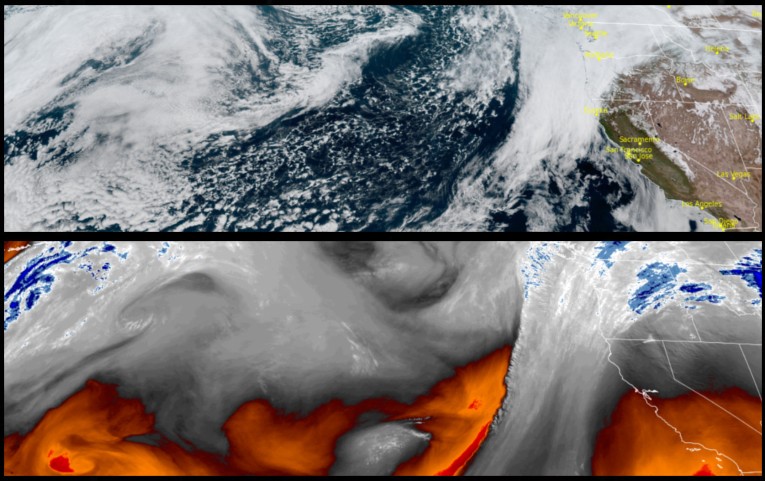
The long period of wet weather that has relentlessly persisted into spring is showing signs of weakening and improving chances for cooler dryer air to move over southern Oregon and northern California a northwesterly flow pushes the currently stalled front to the east.
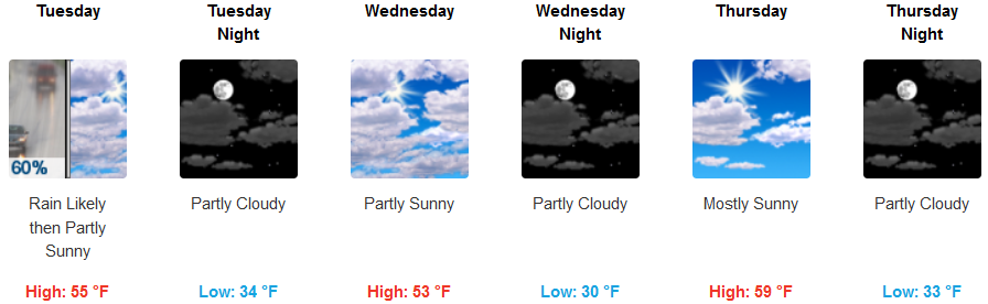
Inland areas can expect to see rain through most of Tuesday with snow levels dropping to 1500ft. early Wednesday morning as skies begin to clear. Partly to mostly cloudy skies are expected as the work week continues with possible localized showers Wednesday through early Thursday and temperatures falling into the mid to low 30’s mid-week before warming slightly as the work week proceeds.
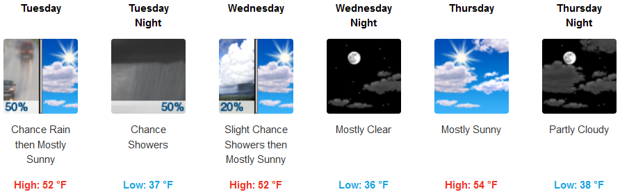
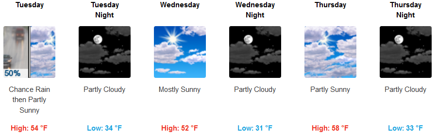
Along the coast chances of precipitation including localized showers are expected to continue throughout the week with temperatures cooling Wednesday with an increase in chances of localized showers through Thursday. Temperatures will cool to the mid 30’s for lows with highs reaching the mid 50’s later in the week.
Brookings:
Crescent City:
Gold Beach:
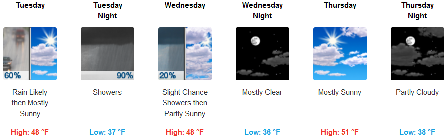
Cave Junction:
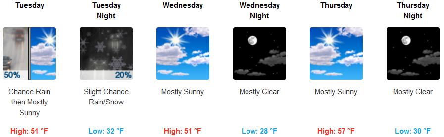
Grants Pass:
Medford: