


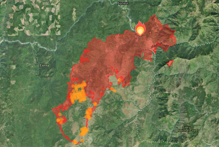
As we start the week, now three weeks into the Flat Fire after it was originally reported July 15, favorable weather conditions and hard work ahead of the fire has continued to keep fire growth slow over the past week. Covering 24,329 total acres Friday morning, and burning at a rate of 1,131 acres per day. The Flat Fire has now charred more than 25,572 acres, growing just 1,243 acres since Friday morning, at less than 450 acres per day in the past 3 days.
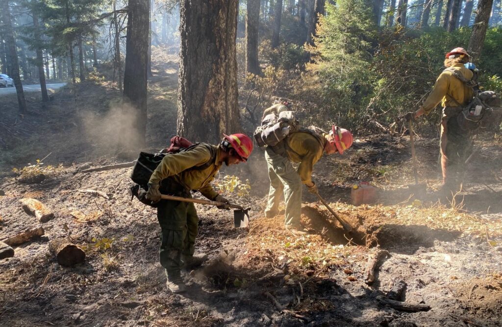
Fire officials continue to utilize the latest technology along the fire line near Game Lake reducing vegetation along the line to starve the fire of fuel and closing the remaining gap of open fire line in that area.
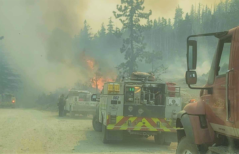
This moves the main fire to the prepared fire line under more favorable and controlled conditions as firing operations continued along the fire line near Game Lake, again reducing vegetation along the line closing the remaining gap of open fire line in that area. The northern line of the fire continues to be patrolled for any hot spots and crews are working on improving the alternate containment lines west of the fire.
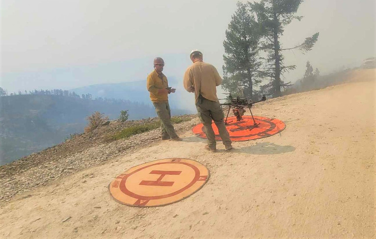
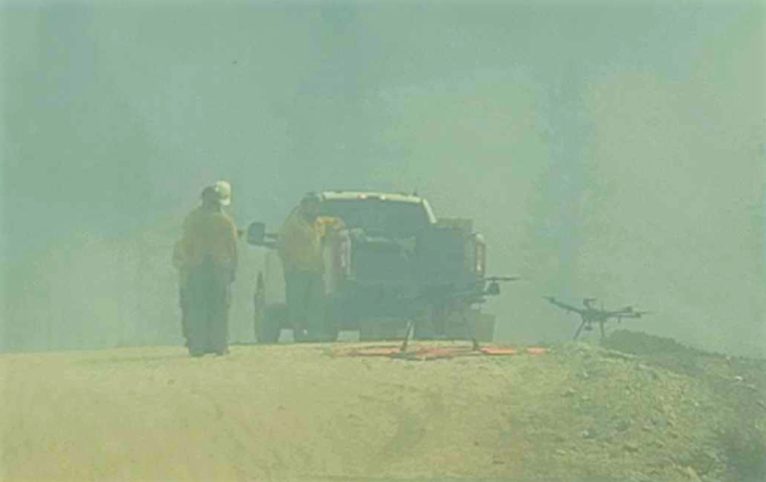
South of Game Lake, in the southwest corner of the fire area, firefighters used aerial ignitions to start fires and burn vegetation in the interior of the fire line. Operations included using Unstaffed Aerial Systems, Drones, and ground-based tools to burn vegetation along Forest Service Roads south of Game Lake. Helicopters used Plastic Spherical Dispenser for aerial firing operations further inside existing firelines, bringing the main fire area southwest towards the fire line.
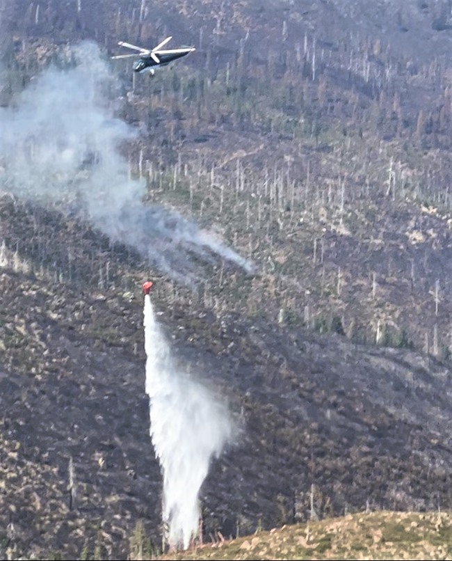
Air resources continue to be utilized as conditions and visibility allow and additional resources continue to arrive and to strengthen and create new firelines while looking for opportunities to use existing roads and bodies of water as natural fire breaks.
Currently the U.S. Forest Service has deployed 1,941 total personnel, 53 Engines, 50 crews, 8 bulldozers, 35 water tenders, 12 helicopters, and 8 masticators, used to grind or chew woody debris into one to two inch pieces leaving behind chipped woody debris.
A Level 1 “Get Ready” evacuation notice remains in effect for areas on the north side of the Rogue River in Old Agness up to Illahe Lodge and along the Rogue River Corridor from Quosatana Creek Campground to the Agness area. This includes the areas of Spud Road, Old House Creek Road and Oak Flat.
Weather conditions forecast call for a small increase in temperatures and winds Monday and abnormally dry conditions and hot temperatures are forecast to persist across Oregon.
Fire Restrictions are in place, including campfires which are only permitted in designated campgrounds that have metal fire rings. Ensure your campfire is thoroughly extinguished before leaving.fs.usda.gov/rogue-siskiyou
The Rogue River Siskiyou National Forest has issued a closure order for the fire area including trails, roads and a portion of the Illinois River. Oak Flat Campground, Game Lake Campground, Wild Horse Campground and Snow Camp Lookout Recreation Rentals are all part of the area closure.
A Level 1 “Get Ready” evacuation notice remains in effect for areas on the north side of the Rogue River in Old Agness up to Illahe Lodge and along the Rogue River Corridor from Quosatana Creek Campground to the Agness area. This includes the areas of Spud Road, Old House Creek Road and Oak Flat.
The area immediately east of Agness remains in a level 2 and the remainder of the areas around the fire are Level 2. The Curry County Sheriff’s Office will continue to coordinate with the Fire Incident Management Team and will notify all residents affected by the fire of any reasons to change evacuation levels. Curry County is using Everbridge to send evacuation notices. You can sign up for notifications here: https://www.co.curry.or.us/departments/emergency_management/index.php