

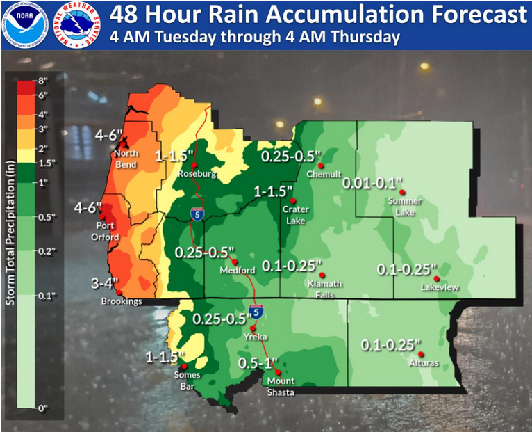
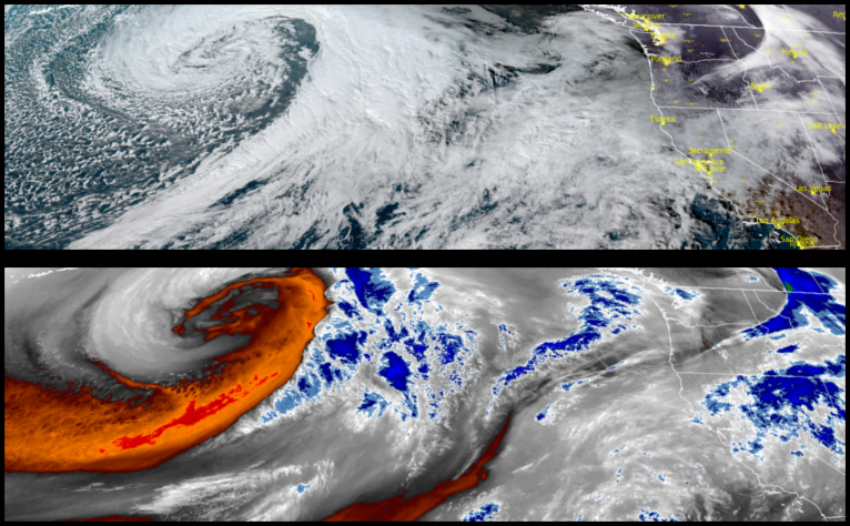
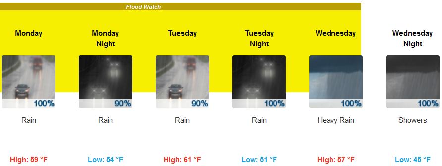
After non-stop precipitation for the last 48 hours, a second round of weather systems is poised off shore to move over the are again leaving another 2-4 inches of precipitation through Thursday. The National Weather Service has issued Flood Watches up and down western Oregon and northern California through mid-week.
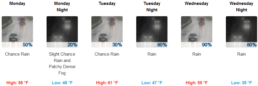
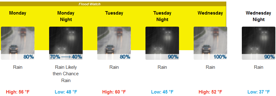
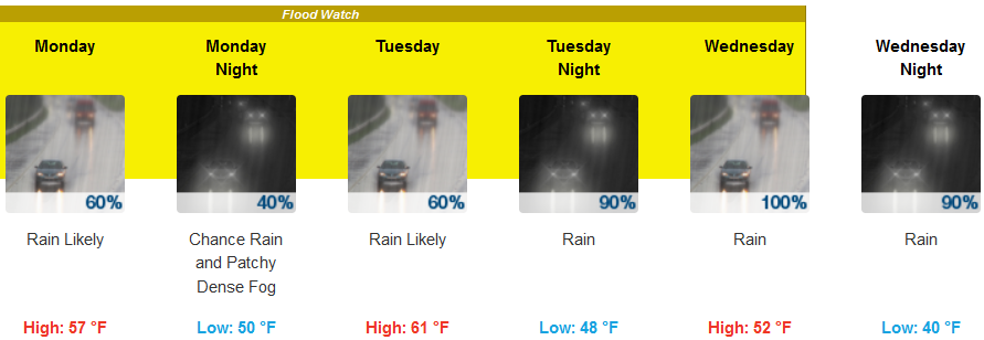
Inland areas are under a Flood Watch as more rain is expected through mid-week. Temperatures will remain relatively warm with lows in the upper 40’s and highs in the upper 50’s to low 60’s.
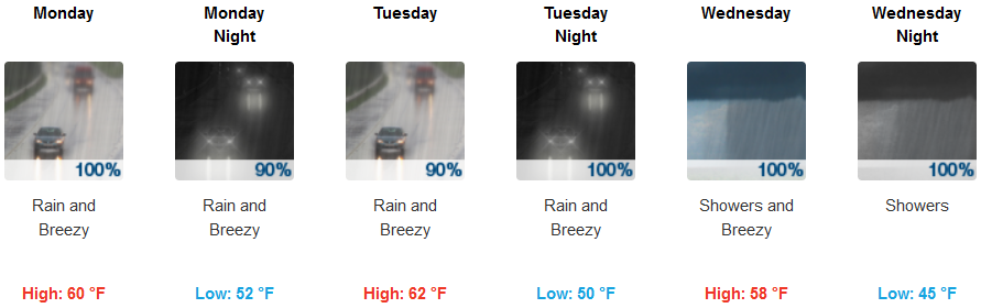
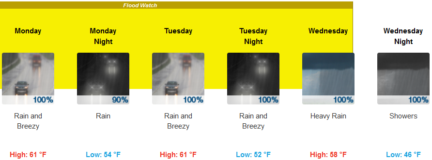
Coastal areas will continue to see relentless precipitation with Flood Watches up and down the coast and continuing through Wednesday. Afternoon high temperatures will stay in the upper 50’s to mid 60’s with early morning lows in the lpw to mid 50’s.
Brookings:
Crescent City:
Gold Beach:
Cave Junction:
Grants Pass:
Medford: