


In Friday mornings official Flat Fire briefing from the U.S. Forest Service, officials revealed that no infra-red imaging was flown Thursday night, and that current acreage would be listed when they are able to conduct another flight. The fires growth slowed slightly Wednesday, and Thursday mornings update shared that infrared imaging performed Wednesday evening, the Flat Fire had grown over 2,461 acres, and now had consumed more than 15,217 acres.
Fire crews are continuing to secure the north section of the fire, improving protection for the community of Agness in the northeast. On the west, firefighters have been able to tie control lines from Illinois River to Wildhorse Lookout.

There has been minimal spread to the north with the most active part of the fire being the west flank. In the southeast where the fire is burning in the Klondike Fire burn scar, fire activity is more moderate, including two spot fires that occurred earlier in the week.
Marine air has moved onshore and is expected to continue into Friday and night shift crews were expected to take advantage of these favorable conditions continuing small burnout areas along the western flank of the blaze. With no infra-red imaging flown Thursday night, the success of burnouts in the northern section performed Wednesday and Thursday in efforts to protect the community of Agness will be determined after the next infra-red imaging is conducted.
With marine air moving into the area, weather conditions have made fire activity more moderate with these conditions forecast to continue into early Friday.
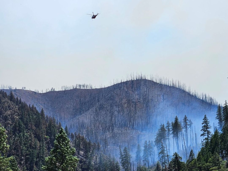
Currently the U.S. Forest Service has deployed 11 Engines, 32 crews, 936 firefighters, 4 bulldozers, 4 water tenders and 8 helicopters, and 8 masticators, used to grind or chew woody debris into one to two inch pieces leaving behind chipped woody debris.
Air resources continue to be utilized as conditions and visibility allow and additional resources continue to arrive and to strengthen and create new firelines while looking for opportunities to use existing roads and bodies of water as natural fire breaks.
The Curry County Sheriff’s Office issued evacuations notice yesterday from Agness to Quosatana Creek. Curry County is sending evacuation notices utilizing Everbridge, which provides notices via phone. If you have not done so, please sign up by going to the Curry County website and click on the Everbridge notification link. https://www.co.curry.or.us/departments/emergency_management/index.php
A community meeting has been announced for Saturday, July 22nd, at the Gold Beach High School cafeteria at 29516 Elllensburg Ave., in Gold Beach, Ore., at 3:00pm.
Also, the Rogue River Siskiyou National Forest has issued a closure order for the fire area including trails, roads, and a portion of the Illinois River and fire restrictions issued Monday also remain in place. So far no official evacuation notices have been issued.