

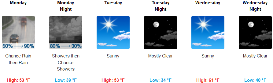
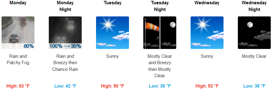
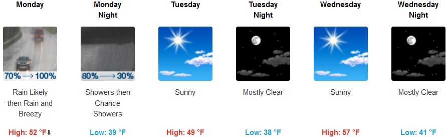
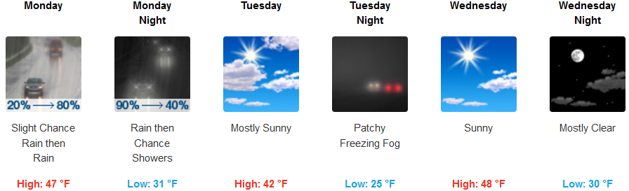
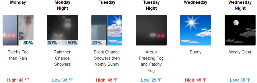
A wet weather pattern is forecast to start the work week as a strong cold front sweeps through the region on Monday. Some areas can expect more precipitation, with heavy rain and snow, along with gusty winds.
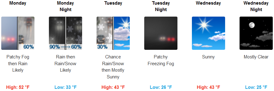
A strong cold front will move through late Monday and bring snow levels down sharply across the region. Snow levels will lower to about 1750 feet Tuesday morning, and there is a low chance that wet roads could freeze in colder valleys and result in some icy roads.
In the valley, as precipitation dissipates, temperatures will change beginning very early Tuesday morning as low temperatures in the low to mid 20’s, and clear skies continue into mid-week.
On the coast rain will be heavier the farther you travel north Monday with low temperatures in the upper 30’s, clearing Tuesday and continuing into mid-week.
Brookings:
Crescent City:
Gold Beach:
Cave Junction:
Grants Pass:
Medford: