

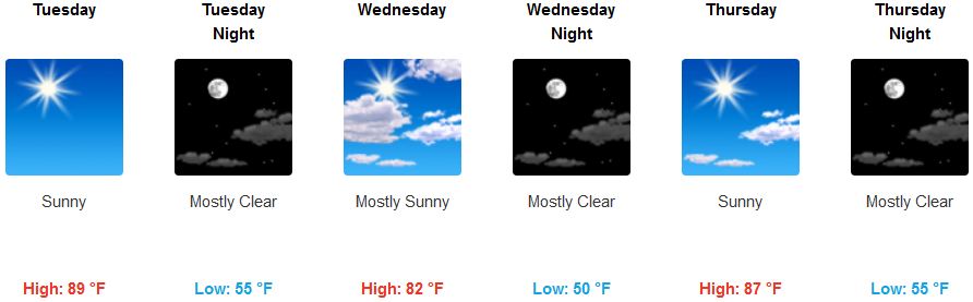
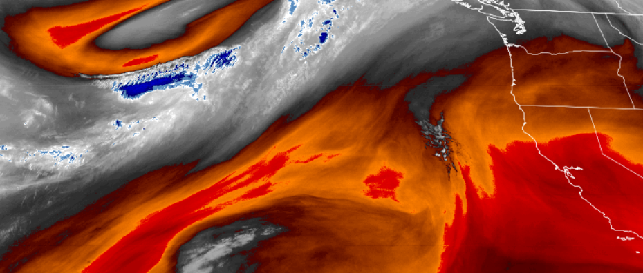
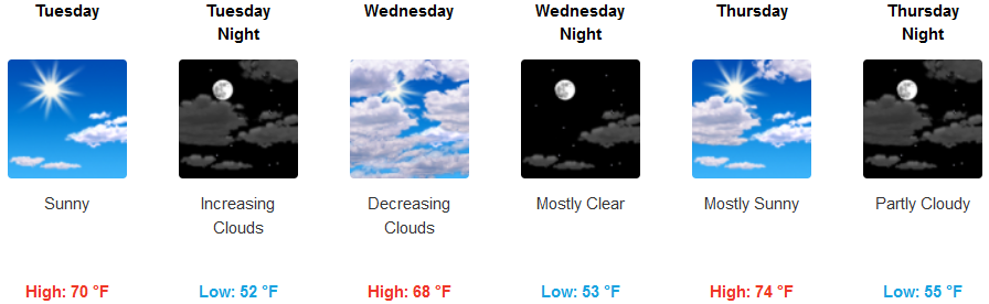
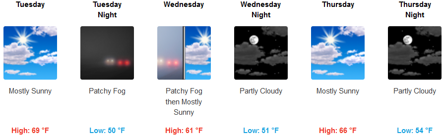
After a low pressure system swept through much of the northwest over the past weekend ushering in brief but substantial precipitation, a ridge of high pressure and dry conditions are expected through midweek.
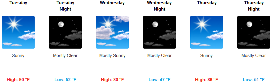
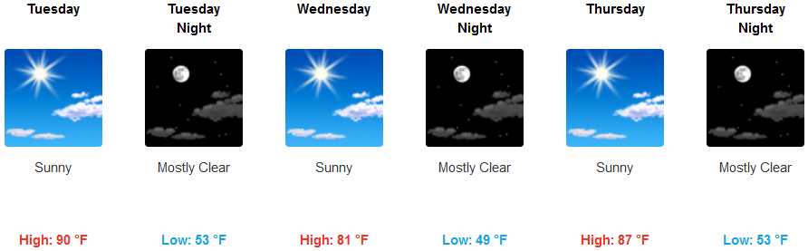
Inland, mostly clear skies are forecast with slight afternoon breezes. The ridge of high pressure is expected to keep temperatures warmer than usual. High temperatures are expected to reach the low 90’s while low temperatures stay in the low 50’s at night.
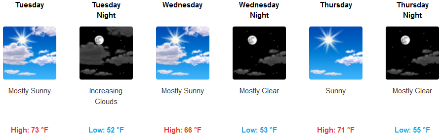
This ridge of high pressure is also expected to bring above-normal temperatures along the coast, before moving east. Some areas will see localized early morning fog and/or marine layer before 11:00am. High temperatures are forecast to reach the mid to upper 70’s with early morning lows in the mid 50’s.
Brookings:
Crescent City:
Gold Beach:
Cave Junction:
Grants Pass:
Medford: