

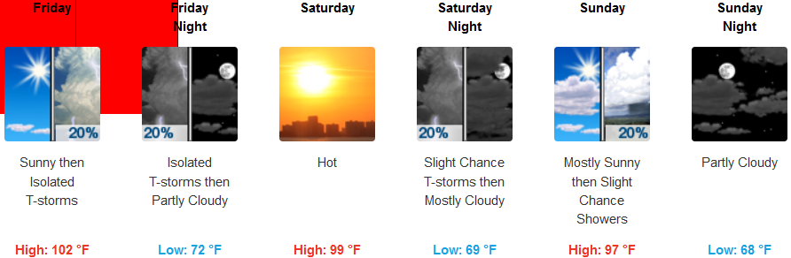
A ridge of high pressure is beginning to establish over the region as the remnants of the monsoonal moisture circulating up from the southwest continues to move east. Localized areas could see thunderstorms as unstable air passes the region.
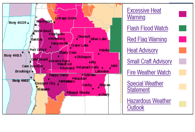
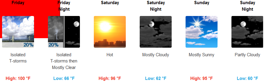
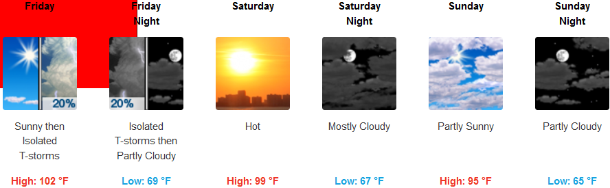
The high pressure will raise temperatures in the valley back into triple digits throughout areas inland. Excessive Heat warnings and Red Flag warnings are in effect due to the possibility of lightning. Temperatures are forecast to reach 102 for highs with little relief in the evenings with morning lows in the upper 60’s.
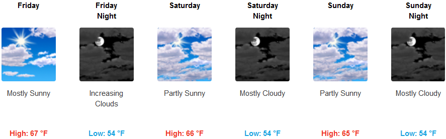
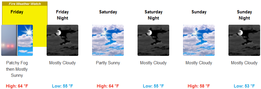
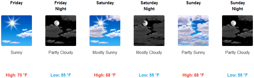
The coastal areas will see mostly clear skies with some clouds moving into the area Friday evening as pockets of warm moisture circulate through, causing a Fire Watch Warning in the Crescent City area with the possibility of lightning. Highs will remain below 70 staying in the upper 60’s with lows getting down to the mid to upper 50’s.
Brookings:
Crescent City:
Gold Beach:
Cave Junction:
Grants Pass:
Medford: