


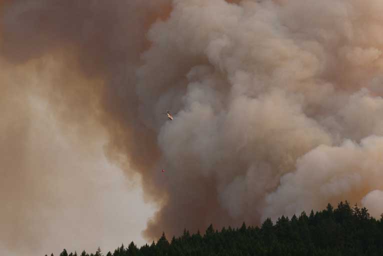
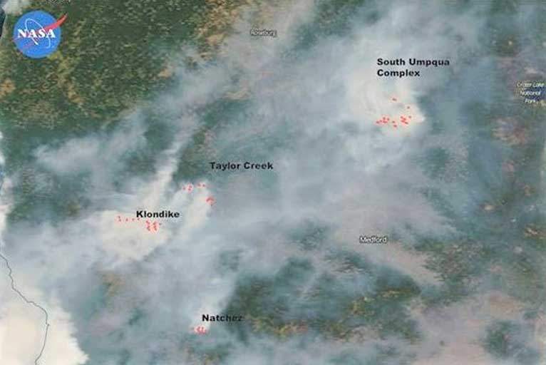
The Taylor Creek fire, burning just 10 miles west of Grants Pass, has added over 2,045 acres in the last 24 hours reaching more than 31,600 acres and 35% containment as of late Thursday evening.
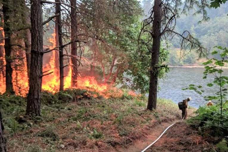
Firefighters successfully burned out areas along the Rogue River yesterday to halt fire spread toward homes in the Hog Creek and Picket Creek areas on the northeast corner of the fire.
This area remains the number one priority and crews will continue to work throughout the day to secure and mop-up around structures and burn out pockets of unburned vegetation to strengthen control lines. The Oregon State Fire Marshal structural firefighters continue to patrol the Green Tree Loop area. The Oregon State Fire Marshal has a quick-response force on the east side of the Rogue River to respond to any spot fires.

Another important objective is to protect structures and timber resources on the west side of the fire. Structure preparation is complete in the Galice Creek and Taylor Creek areas and firefighters are in place to defend those structures as the fire backs downslope toward containment lines. While crews finish preparing Bearcamp Road and Chrome Ridge Road as the primary containment line to halt the fire’s westward advance, they continue to look for opportunities closer to the fire edge to keep the fire as small as possible.
On the southern portion of the fire, engines continue to patrol the Limpy Creek and Shan Creek areas as crews mop-up farther in to strengthen those control lines.
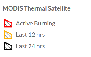
The 1,154 firefighters and officials are confident that the southern flanks have been lined with manageable containment lines as recent thermal images show the majority of growth now on the northern edge of fire.
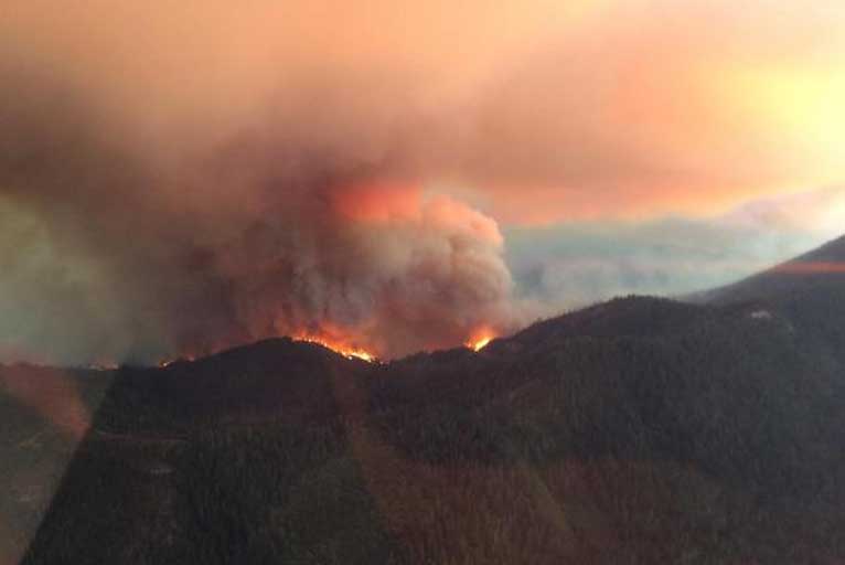
Though temperatures have dropped a bit and relative humidity has risen the fuels are still very dry. Northeast winds should push out smoke this morning which may allow the fuel to receive more solar radiation leading to an increase in fire behavior.
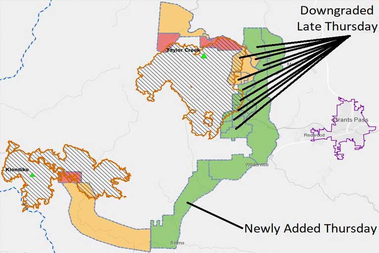
Residences around the Taylor Creek Fire have been subject to numerous evacuation notices and the Josephine County Sheriff’s Office is downgrading some evacuation areas in the Taylor Creek fire.
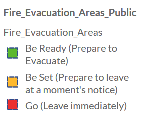

According to the Josephine Sheriff’s Office, level 3 GREEN or “BE READY” evacuation areas have been applied because of the Klondike Fire all along the west side of Hwy. 199 from Selma, meeting the level 3 GREEN or “BE READY” evacuation area of the Taylor Creek fire and extending all the way Wilderville just outside of Grants Pass.
The now 21,352 acre Klondike Fire added 5,440 acres in the last 72 hours as crews worked feverishly to improve indirect containment lines along the east side on Forest Roads and old Biscuit dozer lines north of the fire. These indirect control lines were selected for use because they have the highest probability of successfully stopping further spread of the fire in the steep and rugged terrain and providing for public and firefighter safety.
Firefighters also continued to look for opportunities to implement direct control lines closer to the fire that could reduce the overall fire’s footprint.
Structure protection in Briggs Valley to the north and in Store Gulch and McCaleb Ranch to the south continued. Engine crews also patrolled Josephine County Oak Flats. Fire managers continued to monitor fire spread towards the Chetco Bar and Biscuit fire scars to the west-northwest and assessed any needed suppression actions. Smoke limited air operations for most of the day.
Crews will also continue structure protection in Briggs Valley north of the fire while improving the indirect control line from Forest Road 25 south along the dozer line to Illinois River Road. South of the fire, structure protection will continue and crews will be improving the indirect containment line by removing heavy fuels.
If conditions allow, firefighters may use low-intensity burn outs to remove vegetation between the primary containment line and fire, creating a wide buffer of burned fuels to stop the fire’s eastward progression. Smoke is expected to challenge visibility and limit air operations until mid to late day.
As of late Thursday into Friday morning, Level 3 “Go” evacuation will remain in effect for Oak Flat at the end of the Illinois River Road in Josephine County. Illinois River Road from milepost 2.5 to Oak Flat is at a Level 2 “Get Ready.”
Please Like, Share and Follow the …
![]()