

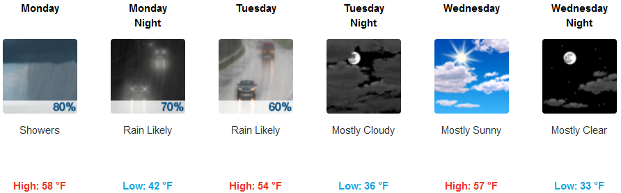
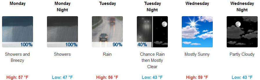
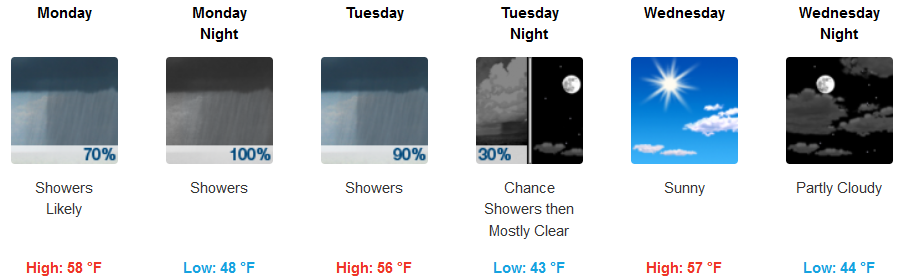
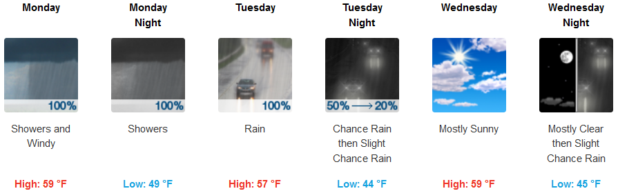
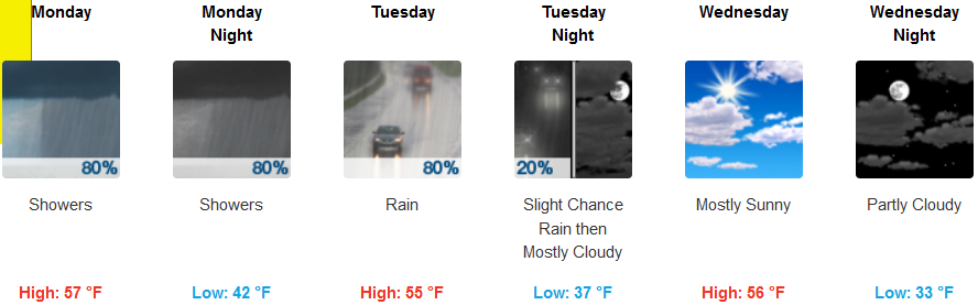
After the cold front that brought the rain over the weekend moved to the east, the next wave of an unsettling weather pattern will continue to bring waves of heavy to excessive rainfall through much of the work week prompting “Flash Flood Warnings” were again issued as above average moisture continues to bring heavy precipitation into the area.
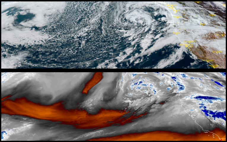
Inland, burn scars in the coastal ranges including the Smith River and Flat fires are particularly at risk for debris flows and “Flash Flood Warnings” have again been issued by the National Weather Service for areas including Cave Junction and Grants Pass. Rain is forecast to continue into mid week with heavy rain continuing through the work week. Temperatures are expected be in the low 40’s dropping to the upper 30’s for lows with afternoon highs in the mid to upper 50’s.
The coast is expected to experience the heaviest rainfall along and near the coast as an extended weather system moves over the region and continues to mid week with heavy rainfall across the Smith River and Flat fire burn scars. Coastal areas should expect morning lows to fall as the week progresses with morning lows in the low 40’s, with afternoon highs in the upper 50’s.
Brookings:
Crescent City:
Gold Beach:
Cave Junction:

Grants Pass:
Medford: