

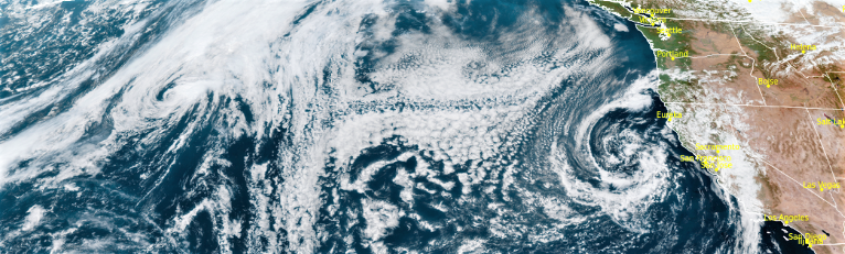
Early Fall rain showers are expected through Wednesday over portions of Southern Oregon and Northern California with chances of thunderstorms, however, snow levels will remain above 7000 feet.
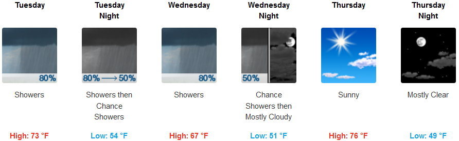
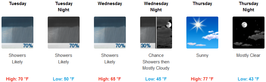
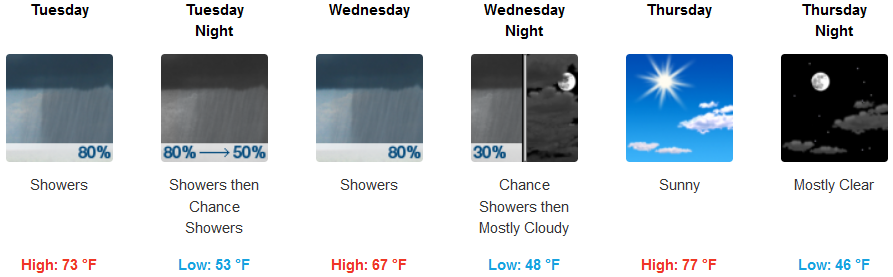
Inland areas can expect showers likely through Wednesday and into early Thursday, with chances of thunderstorms and 5-10 mph south wind. Areas of southern Oregon and northern California are forecast to continue increased cloudiness, clearing late Wednesday to partly cloudy skies. Temperatures are forecast to be in the upper 60’s to low 70’s as the work week progresses.
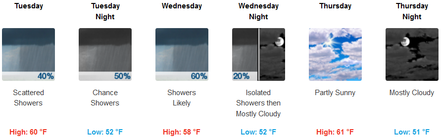
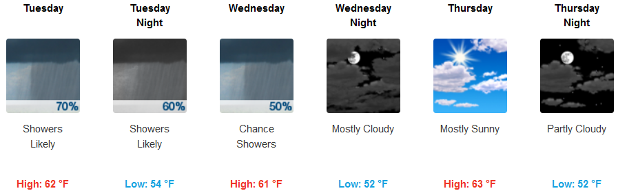
Coastal regions could see showers develop early Tuesday as a low pressure system circulates moisture into the region. Chances of thunderstorms persist across the area as unsettled air pushes ashore. Showers are forecast to continue through Wednesday, before clearing to partly cloudy skies late in the week. High temperatures are expected to stay in the upper 50’s to mid 60’s.
Brookings:
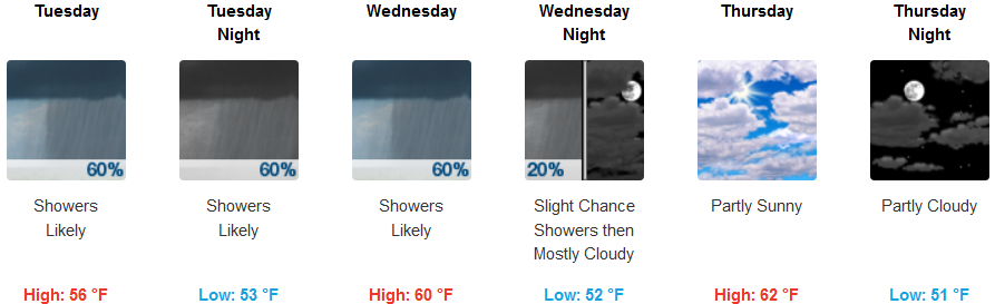
Crescent City:
Gold Beach:
Cave Junction:
Grants Pass:
Medford: